FRAM_rutebilder_2158

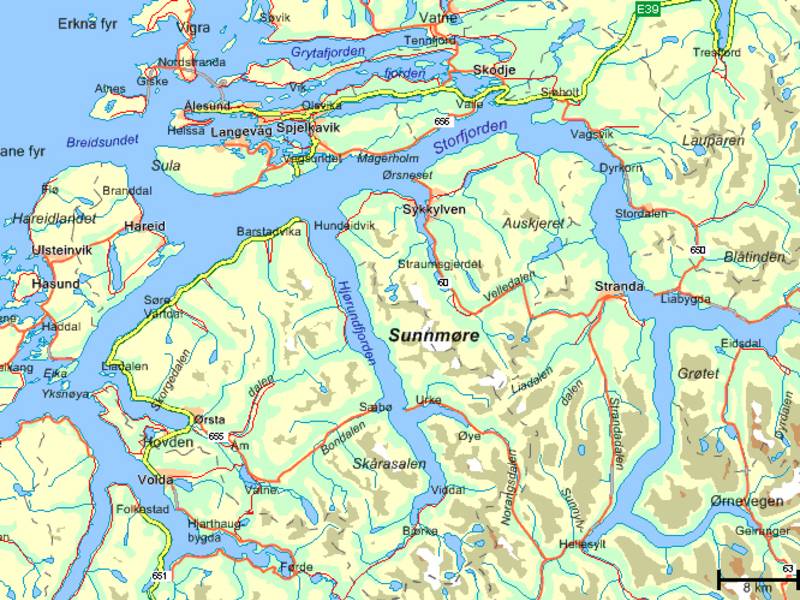
Ålesund - Åndalsnes, Trollstigen & Valldal (round trip)

Provided by:

FRAM

Placeholder image

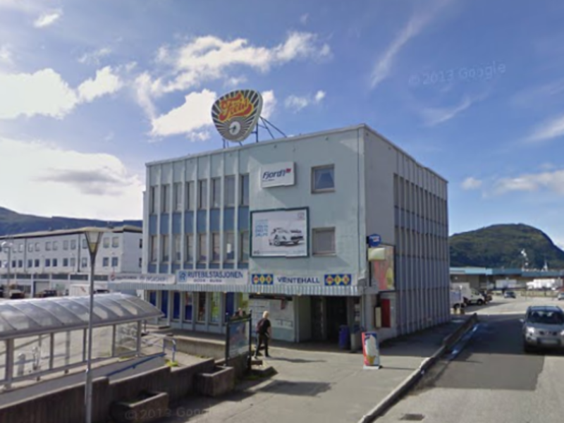
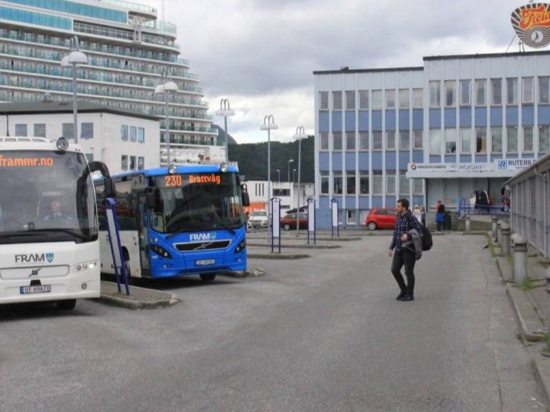
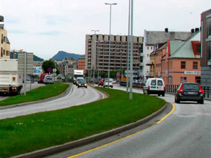
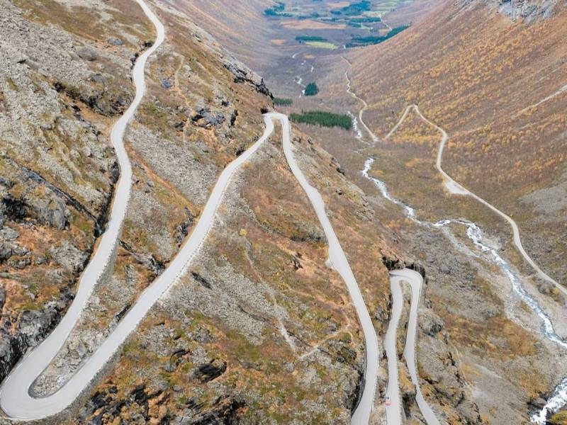
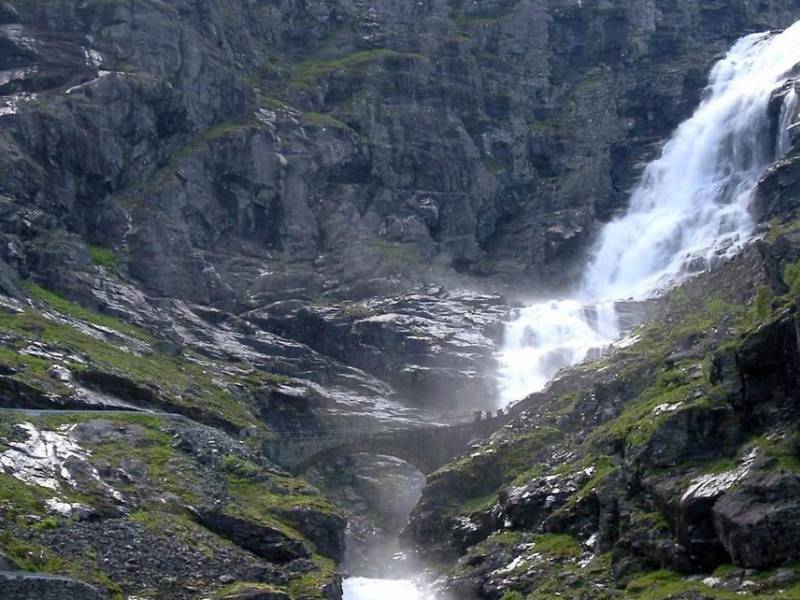
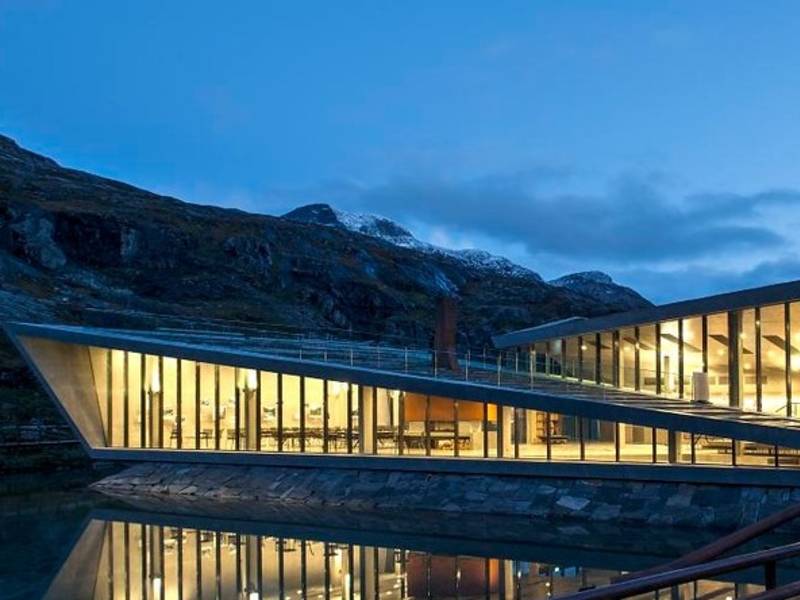
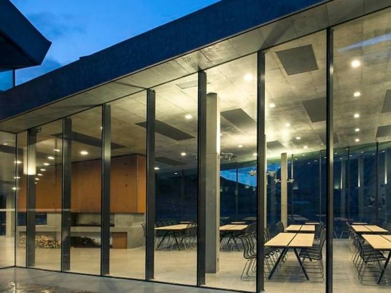
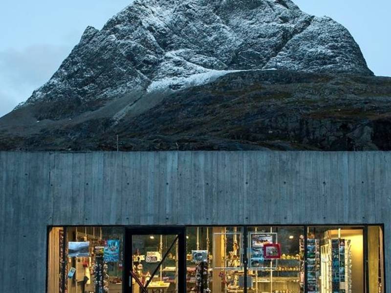
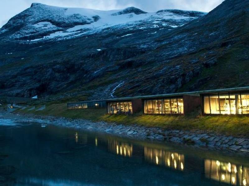
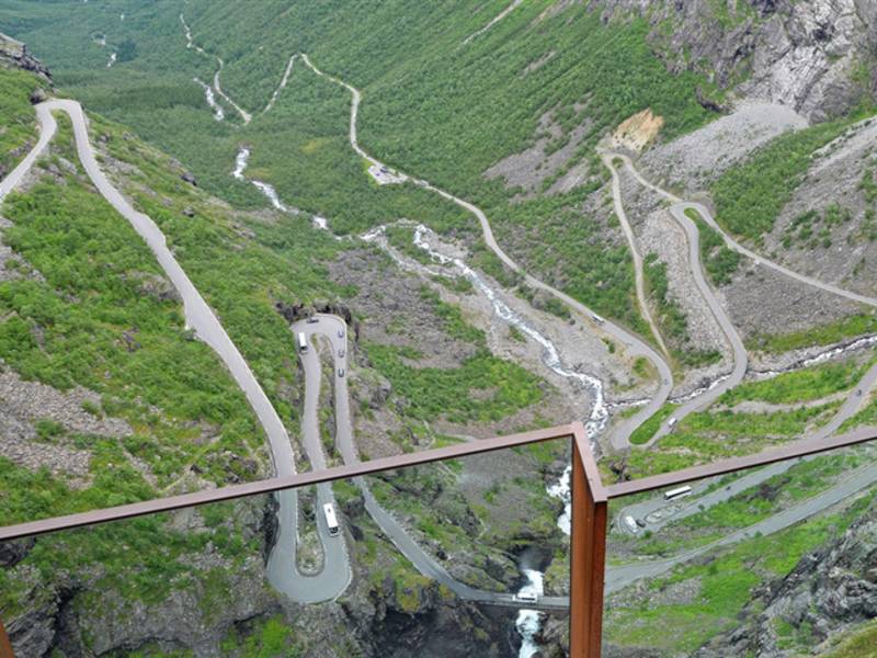
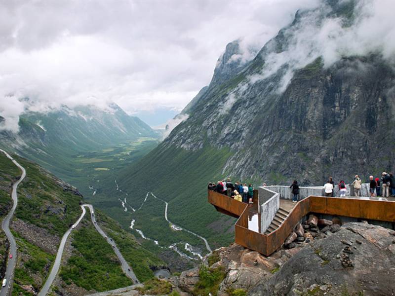
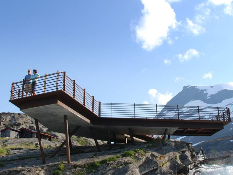
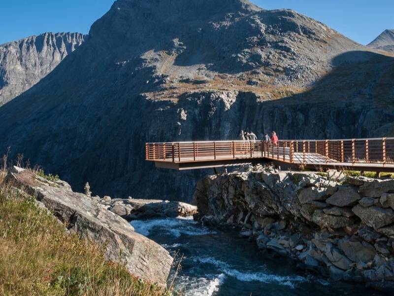
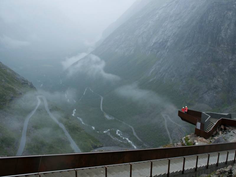
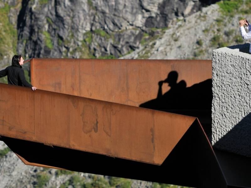
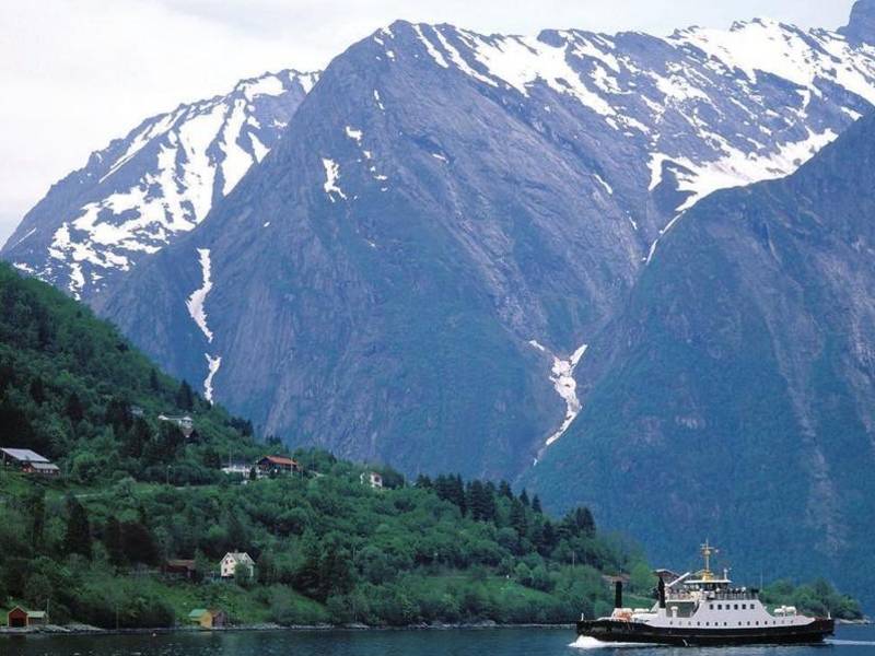
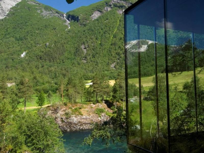
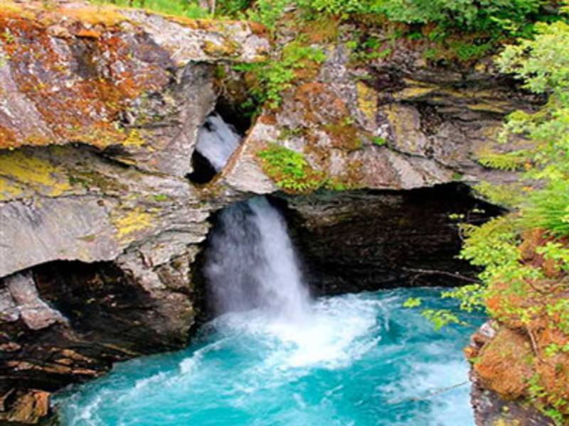
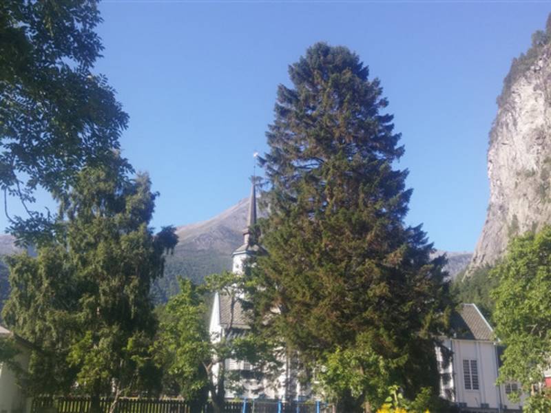
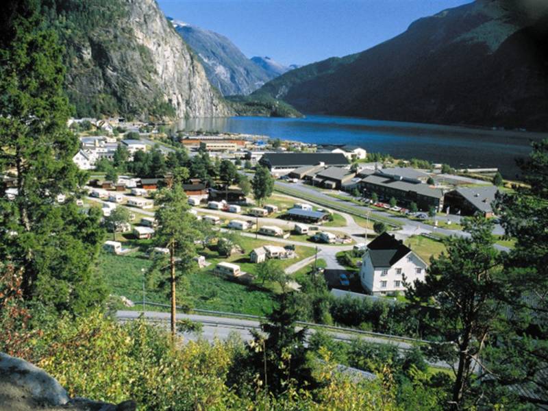
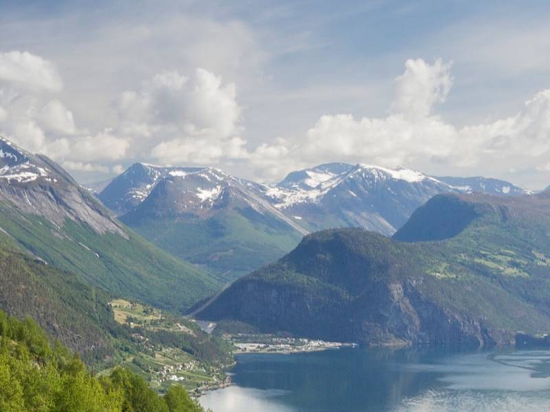
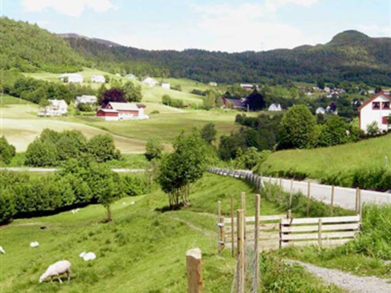
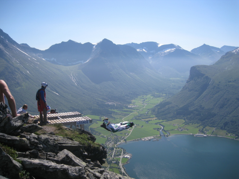
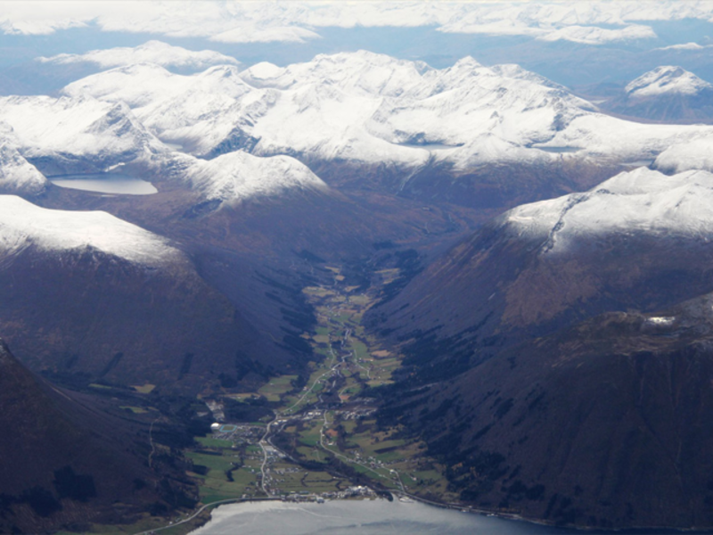
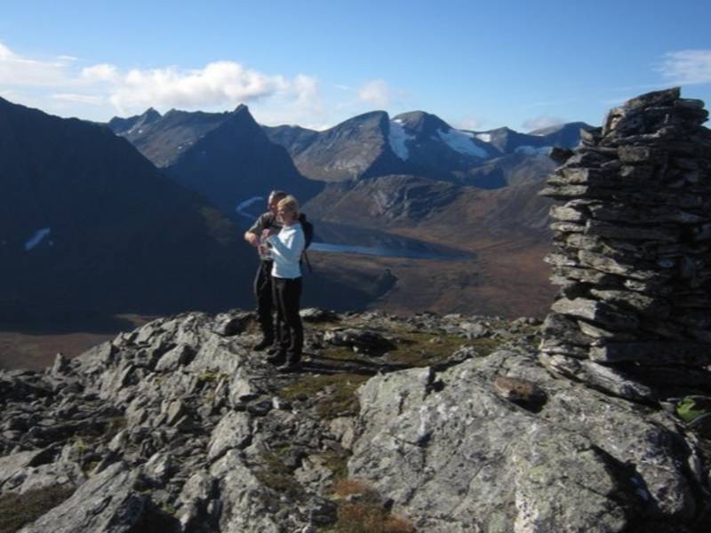
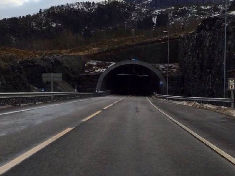
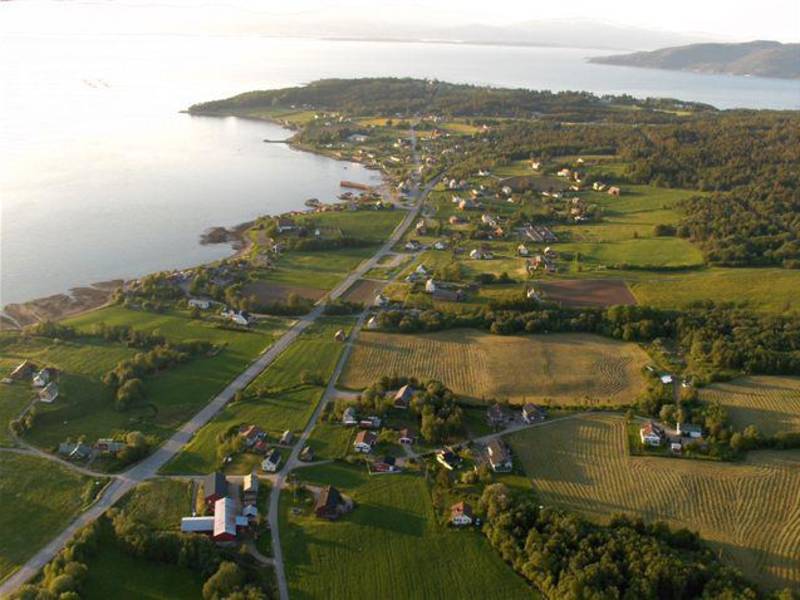
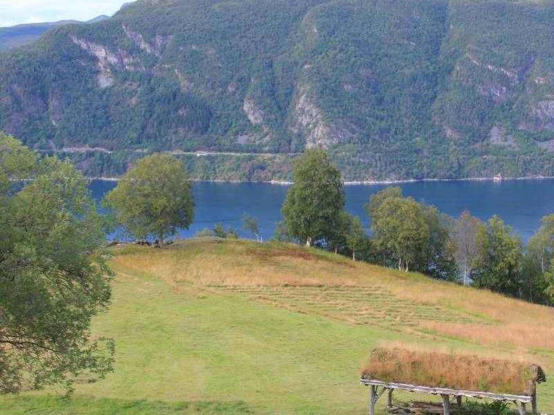
This round trip goes straight from Ålesund to Åndalsnes before embarking on Trollstigen - one of the best known and most visited tourist sites in Norway. If you go on the early departure from Ålesund you time in Åndalsnes to enjoy some of the possibilities offered there, for example a hike up to “Rampestreken”. https://fram.trekksoft.com/en_GB/activity/57226/rundtur-til-trollstigen-valldal Towards Trollstigen, the hairpin road leads up to the summit 850 meters above sea level, offering breathtaking views as the bus curves upwards. The bus stops for 25 minutes at the Trollstigen plateau, allowing you to enjoy the views and take photos. The return journey to Ålesund goes through Valldal, a beautiful valley surrounded by mighty mountains. The climate in Valldal makes it the perfect place for agriculture, especially for growing strawberries. Departure from: Ålesund bus terminal, track 4 About our trips: This trip is a “Travel like the locals” tour by FRAM - the brand for public transport in Møre and Romsdal county. Our “Travel like the locals” tours use the regular FRAM buses, ferries and boats, but we have done the planning for you so that you can concentrate on enjoying your trip. You travel on your own - there is no guide or tour leader. On most of our tours you must change several times between different buses/ferries/boats, and it is up to you to make sure you catch your connections – truly travelling like a local! (The tours are set up so that the buses, ferries and boats connect.) With Hopperguide, you are all set and will get guiding on your ear!

Audio guides available in:
Norsk bokmål, English (British)

To find more content and listen to free audio guides, download the Voice of Norway app.

apple-storegoogle-play

Points of interest

#1

Ålesund Rutebilstasjon

(Photo: bypatrioten.com) From Ålesund Rutebilstasjon (Bus station) you can jump on one of the many buses to transport you both near and far. Especially popular are the many tours with the FRAM buses. These will take you to unique nature, and places you just have to experience. Download one of the audio-guided routes, and experience the amazing region in a new way.

Audio guides available in:
Norsk bokmål, English (British)

#2

Ålesund

(Photo: iStock.com) Ålesund is the largest town in Møre og Romsdal. The town is one of the world's main exporters of dried and salted cod and is internationally renowned for its characteristic architecture — a result of the catastrophic fire in 1904 which destroyed almost the entire town centre. More about this in Jugendstilsenteret. Today, Ålesund's population is growing, and is expected to surpass 50,000 inhabitants in a few years.

Audio guides available in:
Norsk bokmål, English (British)

#3

Linge

Linge is a village with a ferry connection between Åndalsnes and Geiranger. It is situated by Norddalsfjorden which is part of the fjord landscape between Storfjorden and Geirangerfjorden. The place is one of the northernmost with climatic conditions that allow fruits and nuts such as walnuts and peaches to be grown, but it is perhaps most well-known thanks to Martin Linge, the actor and member of the Resistance during World War II who grew up here. You can also see here a memorial dedicated to him. Eidsdal - Linge is a ferry connection on county road 63 and crosses Norddalsfjorden. The trip is 2.7 kilometres long and takes about 10 minutes. At Linge ferry terminal, there is a connection between county roads 650 and 63.

Audio guides available in:
Norsk bokmål, English (British)

#4

Åndalsnes

Here, surrounded by majestic mountains, deep and lush valleys and emerald green rivers, lies Åndalsnes, or Tindebyen which is full of spectacular experiences. The town was also at the centre of one of the second world war’s largest battles, during which the whole of Norway’s gold reserve was at stake. In dramatic fashion, Norwegian and English soldiers together with hundreds of heroic volunteers managed to save the Norwegian gold and cash reserves, whilst howling German bombs squealed around them leaving the whole town in ruins. Both the town and the steadfast people rose up again and to this day exist as a hub between the fantastic Norwegian mountain experiences both in Summer and Wintertime. The idyllic fjord centre has all you need and more. We recommend the spectacular walk up the Romsdalstrappene to the Rampestreken viewpoint, which literally hangs out 8 meters in the air, giving you an eagle’s eye view over Åndalsnes and the beautiful Romasdal fjord. On your way down again we recommend taking the award winning Romsdal Gondola for all of you without a fear of heights. And if you should hear some rough guitar riffs or some banging dance tunes, then maybe Raumarock or another of Åndalsnes’ famous music festivals is taking place.

Audio guides available in:
Norsk bokmål, English (British)

#5

Sport Angling Rauma

Several decades before sports angling became popular in the Rauma area, stories are told about the English Lord Beresford and his friend William Bromley-Davenport who came to Veblungsnes on the yacht Coral Queen a day in June 1849. As soon as they saw the estuary of the Rauma river they visited the post master to inquire about the possibilities for salmon fishing. They were advised to move up the river, to Fiva, which at the time was owned by a young girl, Marianne Løchra. In a letter to his father, Willaim describes his experiences from fishing in Rauma: "…after 14 pleasant days by Romsdalsfjorden, where we in a river called Rauma caught nearly 330 salmon - an enormous quantity, and more than has ever been caught here even with a fishing net over a whole summer. It is strange that these people don't learn fly fishing, since their existence is almost entirely dependent on the fish they catch. As we gave away almost all the fish, except what we needed ourselves, we were welcome quests, and a large number of these poor farmers gathered around us and screamed with joy as we pulled salmon after salmon out of the river. They though it was some kind of magic. Many of them assured us before we started that it was impossible to catch this big salmon with such simple equipment and angles." William later returned to Romsdalen and established a home here by buying Fiva in 1862. To this date, Fiva is owned by his successors, carrying his name.

Audio guides available in:
English (British), Norsk bokmål

#6

Main road

This is the main road in and out of Ålesund centre and consists of Aspøya and Nørvøya. Along the way, you will find the Color Line Stadion, the home ground of Aalesund Football Club.

Audio guides available in:
Norsk bokmål, English (British)

#7

The Norwegian Maritime Competence Centre

Ahead of us is the region’s hub for education, research, and business development, Campus Aalesund. A high school and the Ålesund campus of Norway's largest university on one side of the road, and global companies on the other side paves the way for interaction between theory and practice. NTNU has mainly a science and technology profile, a variety of programmes of professional study, and great academic breadth that also includes the humanities, social sciences, economics, medicine, health sciences, educational science, architecture, entrepreneurship, art disciplines and artistic activities. Norwegian Maritime Center of Comptetenece - NMCC - aims to be one of Norway’s most important meeting places for innovation, competence and development. NMCC cooperates with a number of organizations both inside the NMCC building and outside to create more knowledge, innovation, development, and growth in the Sunnmøre region.

Audio guides available in:
English (British), Norsk bokmål

#8

Trollstigen

Trollstigen ('The Troll Ladder') ; is made up of eleven hairpin bends on county road 63 at the end of Isterdalen valley in the Rauma municipality. The Trollstigvegen road connects Valldal in Sunnmøre to Romsdalen and Rauma. The road is only open during the summer, usually from mid-May until the first snowfall in the autumn. After being under construction for almost eight years, the road was opened by King Haakon VII on July 31st 1936. The road was constructed following approximately the same path as a more ancient path called Kløvstien. This old traffic artery between Romsdal and Sunnmøre has been restored and signs have been put up, including signs indicating the footpath. The biggest challenge was the steep gradient at the edge of Isterdalen where the road zigzags its way up to Stigrøra. The eleven hairpin bends each have a radius of about 10 meters. Below the 180 metre high Stigfossen waterfall there is a bridge, and when the water flow is high, water splashes across the bridge. Because of repeated rock avalanches, especially in the winter, and parts of the road being destroyed, part of the road was rerouted in 2005. Two new bridges had to be built across the river Istra. The Trollstigvegen road is one of Norway's most visited tourist attractions. At the summit of Stigrøra, there is a large car park and a viewpoint.

Audio guides available in:
English (British), Norsk bokmål

#9

Sunnmøre Museum

Sunnmøre Museum, located on the southern side of the bay, along E136, is a folk museum with exhibitions of cultural history, and a comprehensive collection of old houses and boats. Enjoy a walk among the characteristic houses and gain insight into the cultural history of Sunnmøre and old building methods. The museum documents and exhibits Sunnmøre's cultural history from The Stone Age to The Modern Era. The museum itself consists of 50 houses and 40 boats.

Audio guides available in:
Norsk bokmål, English (British)

#10

Stigfoss bridge

(Photo: wikipedia) You are now crossing the Stigfossbrua bridge on county road 63 which passes above the Stigfossen waterfall in Trollstigen. The bridge and the road were opened by King Haakon VII on July 31st 1936. The construction of the bridge started in 1933 and the construction of the walls was completed in 1934 and 1935. On one of the large stones put up along the side of the road, one can read "Stigfossbrua 1935" carved into the rock.

Audio guides available in:
Norsk bokmål, English (British)

#11

Trollstigen Cafe

(Photo: Reiulf Ramstad Arkitekter AS, Jiri Havran / Statens vegvesen) At the top of of the sharp turns from Isterdalen, you will find the Trollstigen plateu. Hre you will find a service building with a café, souvenir shops and toilet facilities. The café and shops are normally open from mid-May to September. By the service building there are beautiful water mirrors, bridges, and paths to the viewpoints where you can see the winding road, impressive waterfalls and the wild and stunning nature.

Audio guides available in:
Norsk bokmål, English (British)

#12

Ålesund Hospital

Ålesund sykehus (Ålesund Hospital), the region's largest hospital, is situated between the E136 road and the fjord. Before the current hospital was built in the 1960s, Ålesund Hospital was in an old building in downtown Ålesund. The hospital offers diagnostics, treatment, rehabilitation and care for patients in Sunnmøre. In addition, the hospital has a range of functions covering the whole county.

Audio guides available in:
Norsk bokmål, English (British)

#13

Trollveggen and Romsdalen Valley

(Photo: Øyvind Heen - Visitnorway.com) The Romsdalen valley is long and narrow with majestic towering mountains on either side. Along the valley floor in a wild and beautiful setting runs the foaming salmon river, Rauma. At Verma, the Rauma goes through a 30-40 meter high gorge and forms the waterfall Slettafossen. Scandinavian rock climbing started in the Romsdal mountains, which boast some of the world's most difficult climbs. At 1,000 metres, Trollveggen, the Troll Wall, is Europe's tallest vertical, overhanging rock face. On the opposite side of the valley, the Romsdalshorn peak towers to a height of 1,555 metres. Romsdalshorn is a very popular climbing site for Norwegian as well as international climbers. The Romsdalen mountains are also popular among base jumbers. However, from the late 1980s base jumping from Trollveggen has been illegal, after a number of serious accidents with risky and expensive rescue operations.

Audio guides available in:
Norsk bokmål, English (British)

#14

Amfi Moa

Do you like shopping? Then you have come to the right place. We are now at Amfi Moa, which with its 170 stores is among Norway's largest shopping centers in terms of turnover.Many well- known chain stores can be found here, as well as many unique, independent stores. The centre also has a real estate agency, a pharmacy, The Wine Monopoly and a large selection of eateries. Parking is free.

Audio guides available in:
English (British), Norsk bokmål

#15

Spjelkavik

(Photo: wikipedia) Spjelkavik is a district in Ålesund which includes the areas around Spjelkavik/Moa, in addition to the residential areas of Åse, Lerstad, Olsvika and Fremmerholen. Today Spjelkavik has about 10,500 inhabitants, and is Ålesund's second largest town district. The town district is located about 10 km from the centre of Ålesund and is among the fastest-growing areas in Ålesund.

Audio guides available in:
Norsk bokmål, English (British)

#16

The Golden Route

Trollstigen is part of the Otta - Geiranger - Valldal - Åndalsnes - Dombås road which is called The Golden Route. Since 2005, Trollstigvegen has been one of the roads selected for the project National Tourist Routes. The project's slogan is Safe and Beautiful, meaning that all stops and picnic areas should look harmonious in relation to the nature and landscape. The road's highest point is 850 metres above sea level, at Alnesreset. This was the location of the restaurant Trollstigheimen which was destroyed by an avalanche. It was never rebuilt. The road was renovated between 2005 and 2009 in order to adapt to the increasing number of tourists. This included safety measures against stone avalanches, new rest stops and viewpoints, as well as souvenir shops. The traditional small huts that used to sell souvenirs were removed, at the same time as a new facility with a café and a souvenir shop opened in the summer of 2009. The road is surrounded by several mountain tops which are more than 1,000 metres high. Stigbotnhornet and Bispen are among the most famous. Dronninga and Kongen ('The Queen and The King') ; are to the north west. Trolltindene ('The Troll Peaks') ; with Trollklørne ('The Troll Claws') ;, and the backside of Trollveggen ('The Troll Wall') ; in the north east. The mountains and the many summits in Romsdal are popular among mountain climbers. There are several marked trails, most of which are quite easy to hike, while others require climbing.

Audio guides available in:
Norsk bokmål, English (British)

#17

Sjøholt

We now come to the small village and the traffic hub Sjøholt, which is located where the Ørskogelva River flows into the Storfjorden. Here the traffic is distributed in all directions, whether you are going to Ålesund, Molde, Geiranger or Oslo. The popular petrol station has been a favorite stop for both large and small cars for many decades. Sjøholt has some minor industries within repairs, furniture, plastic, and wood. South of the river mouth of Ørskogelva, you will find Ørskog church, a wooden church with a rectangular basilica built in 1873.

Audio guides available in:
English (British), Norsk bokmål

#18

Plattingen

(Photo: Per Kollstad, Jarle Wæhler / Statens vegvesen) Plattingen is the name of the platform that sticks out over the mountain edge and hovers 200 metres above Trollstigen. It provides a spectacular view of the majestic landscape. The platform has a different viewpoint depending on how brave or prudent you are. The construction is made of steel and glass, and protects against bad weather and winds. Plattingen was designed by architect Reiulf Ramstad Arkitekter AS. There is a short hike along the walking trails and stairs up to the viewpoints.

Audio guides available in:
Norsk bokmål, English (British)

#19

Norwegian Mountaineering Center

Norsk Tindesenter attracts mountain climbers and regular tourists alike. Its main focus is on Norway's mountaineering history. Inside the center, you can start your visit with a cinematic experience allowing for floor-to-ceiling movie viewing. Here, stunning trekking films combined with short historical narratives take you on an exciting adventure trip. The center has a number of interesting installations showing different aspects of the climbing sport, and the driving forces motivating mountaineers. Both children and adults are invited to learn and participate interactively. Real stories have been dramatized and old equipment displayed alongside so you can study the challenges of the climbing pioneers. If you feel up to it, you can test your own climbing skills. Norway's highest indoor climbing wall – Carl's Hall – is here at Norsk Tindesenter. It has routes up to 21 meters. Norsk Tindesenter also has its own children's bouldering cave suitable for children from 3 years of age and upwards.

Audio guides available in:
English (British), Norsk bokmål

#20

Geiranger-Trollstigen

(Photo: Steinar Skaar, Jarle Wæhler / Statens vegvesen) The drive across Trollstigen is without a doubt more dramatic than most are used to. One of the most striking observations one makes when driving around Norway is that there are actually people living everywhere. Even on the narrowest cliff or smallest hill it is possible to spot a house. This is how we are connected to the landscape and nature through settlements where people have lived their lives for generations before us. However, this will probably just be a digression since it is so easy to get lost in the spectacular landscape along this road. Geiranger - Trollstigen offers several highlights, and the drive up the eleven hairpin bends in Trollstigen or as you look out on the Geiranger fjord from Ørnesvingen will get your heart racing. Lush valleys, quiet strawberry villages, steep mountains and viewpoints provide both a sinking feeling and some of most beautiful sights in Norway. Plan plenty of time for the trip, the stops are valuable, whether you want to challenge yourself to a hike to the summit of a mountain or just enjoy the view. There is so much to discover if you take your time to do it. For hundreds of years, the Trollstigvegen road has been an important connection between Valldal and Åndalsnes. At first as a path, then as a horse trail until the construction of Trollstigvegen road started in 1916. Part of the original path is still visible today and it is still possible to walk on it. This is an interesting option for those who want to experience the path the way it was in the old days. Some of the most sensational spots in the area can be found here. The Ørnesvingen, Gudbrandsjuvet and Flydalsjuvet viewpoints allow a special experience of nature. With a ferry on the fjord, you can take a closer look at the famous De Sju Søstre (The Seven Sisters), Friaren (The Suitor) and Brudesløret (The Bridal Veil) waterfalls, and experience the world's most famous fjord, the Geiranger fjord, which is on UNESCO's list of world heritage sites.

Audio guides available in:
English (British), Norsk bokmål

#21

Sunnmøre

(Photo: snl.no) This region in Møre og Romsdal is called Sunnmøre. The word Møre originates from Norse marr, 'ocean, sea', and can be interpreted as "the land by the sea". People from Sunnmøre are called sunnmøringer. Sunnmøre has about 140,000 inhabitants and covers an area of 5,234 km2. Sunnmøre's most important town is Ålesund and this is the biggest town between Bergen and Trondheim. Ålesund is the country's ninth biggest town and lies entirely on islands. Sunnmøre also has two other small towns, Ulsteinvik and Fosnavåg, and several large villages like Ørsta, Volda, Sykkylven, Hareid, Nordstrand, Stranda and Brattvåg. Many islands, long and narrow fjords, including Geirangerfjorden on UNESCO's world heritage list, and Sunnmørsalpene (The Sunnmøre Alps) dominate the landscape. This also gives rise to many nature-related activities. In the Sunnmørsalpene, it is possible to find some of the country's best alpine resorts, known as the "powder paradise". This area offers good opportunities for mountain hiking, climbing, ocean fishing, kayaking and scuba diving. The region also has a wide range of restaurants and accommodation facilities that based on the natural conditions. We recommend that you check out activities on the Visit Ålesund & Sunnmøre's website. A link is available in the app.

Audio guides available in:
Norsk bokmål, English (British)

#22

Juvet Landscape Hotel

The Juvet landscape hotel is walking distance from the Gudbrandsjuvet ravine. Its unique architecture and location have earned the hotel several awards. It has also been mentioned in multiple design and architecture magazines.

Audio guides available in:
Norsk bokmål, English (British)

#23

Valle

Valle is a village and residential area in the Skodje municipality in Møre og Romsdal. The village has about 400 inhabitants and is located between Storfjorden and Skodjevika in Sunnmøre.

Audio guides available in:
Norsk bokmål, English (British)

#24

Fjellstova

We are soon passing Fjellstova on Ørskogfjellet, Which was constructed in 1966 by an industrious fellow named Peder O. Bårdsgjerde. His son Olav relates that it started as a small cafe and later expanded with cabins and rooms to accomodate larger social gatherings. Fjellstova offers a restaurant, 15 cabins and a small campsite, and is open throughout the year. This is a great starting point for several activities in the area. The landscape here is well suited for hiking and rumor has it that there are plenty of blueberries to be found. During winter you will find several cross-country trails and excellent opportunities for other alpine activities. Necessary equipment can be rented, and you can also attend a skiing school. Mountain biking, fishing or just simply enjoying Norwegian nature are other options. Golfing and horseback riding are also offered inn the area.

Audio guides available in:
Norsk bokmål, English (British)

#25

Gudbrandsjuvet

Gudbrandsjuvet is a ravine in the Valldøla river and is part of The National Tourist Route along county road 63 from Geiranger to Trollstigen. The gorge through which the Valldøla river passes is 5 metres wide and between 20 and 25 metres deep. The water has formed a system of potholes and intricate formations. The gorge is as deep below the water surface as above. According to a legend dating back to the 1500s, the ravine is named after a man called Gudbrand who ran off with a bride and escaped the groom by jumping across the ravine at its narrowest point. Gudbrand was declared an outlaw and spent the rest of his days in a stone hut in one of the sidevalleys above the ravine. That is how the valley got its name, Gudbrandsdalen, which is also its current name. The legend doesn't disclose whether or not he managed to take the bride with him across the ravine. There are good facililties to allow visitors to enjoy the view safely. There is also a café with an architectural style that matches the surrounding landscape.

Audio guides available in:
Norsk bokmål, English (British)

#26

Jordbærstova

Jordbærstova is located in the middle of the strawberry fields in Valldal. Here you can taste freshly picked strawberries, enjoy a nice meal, a good night's sleep or an exciting hike in the strawberry fields. Join a hike in the strawberry landscape and receive a tasty portion of local know-how. The hike takes about one hour and a reservation must be made a day in advance.

Audio guides available in:
Norsk bokmål, English (British)

#27

The Swedish border on Ørskogfjellet

Perhaps hard to believe in our time yet you are now close to where the border between Norway and Sweden was once drawn. For a short period of time toward the end of the 1650`s, the boundary was equivalent to what today separates the municipalities of Vestnes and Ørskog. The reason behind this border line was a war known as Krabbekrigen (The Crab War). It had nothing to do with crabs; it was named after the commander-in-chief of the Norwegian army in Bohuslen, Iver Krabbe. The war was fought between Denmark-Norway (Norway in those times was a part of Denmark) and Sweden. In 1658 the war came to a peaceful end. Denmark-Norway had to give up the entire Romsdal County to Sweden. Therefore the Swedish border was here - for just a couple of years -before the story took new directions.

Audio guides available in:
Norsk bokmål, English (British)

#28

Valldal

Valldal is a beautiful village by the fjord, halfway between Åndalsnes and Geiranger. The valley stretches about 30 km from Storfjorden to the top of Trollstigen. Large parts of the valley consist of flat and low-lying grounds with ideal conditions for agriculture, and Valldal is known for its strawberries. Valldal has about 1,000 inhabitants concentrated in an area of 10 km along the fjord. Sylte by Storfjorden is the centre of Valldal and the centre of the Fjord municipality. Valldal is the closest neighbour to two important tourist destinations in Norway, Geirangerfjorden and Trollstigen. From Sylte, the county road continues through a tunnel to Fjørå and then to Tafjord. The road to Tafjord passes through a tunnel below the place where a crag fell down and caused the Tafjord accident in 1934. The big wave reached all the way to Valldal. In these areas you can try rafting, canyoning, spectacular mountain hiking and mountain climbing. You can rent ocean kayaks or spend the day at Valldal activity park for adults and children, a few kilometres in the direction of Trollstigen. The river Valldøla which runs through the valley, is ideal for rafting, but it is also a popular spot for salmon fishing.

Audio guides available in:
Norsk bokmål, English (British)

#29

Shipyards Vestnes

If you happened to travel through this area around the end of the 19th century, you would have seen several shipyards along the fjord. Shipbuilding has a long tradition in Vestnes. However, most of the former companies are now just a part of the history. Hammeraas, Salthammer, Stenødegård, Helland, Ødegård, Aas, and Vestnes are names that still make people in the area think about boat construction. Boats and ships of all sizes were once constructed and built in this area. One of the first most significant Norwegian boatbuilders was Lars Jensen Hammeraas, who was responsible for the construction of one of the largest wooden ships here toward the end of the 19th century, the full rigged ship Herman Lehmkul. It was 214 feet long and as tall as a three-story house. In fact, the boat was so large that they had to reorganize the factory area in order to get enough space for the building process.

Audio guides available in:
Norsk bokmål, English (British)

#30

Vaksvik

The bus now runs along the small village of Vaksvik with its fairytale nature and beautiful surroundings in the middle of the majestic Storfjorden and Vaksvikfjellet. The area, and Vaksvikfjellet in particular, is popular among hiking and outdoor enthusiasts from the whole region and offers many fine hiking trails and ski slopes for the whole family.

Audio guides available in:
Norsk bokmål, English (British)

#31

The municipality Stordal

We now arrive at the beautiful furniture village Stordal, which is nicely situated by Storfjorden and is known as the portal to Geirangerfjorden and the UNESCO world heritage area. Stordal is known for its furniture industry, but farming has also traditionally had a strong position in Stordal with good, natural conditions for stock and growing various vegetables. Tourism is also important for the village.

Audio guides available in:
Norsk bokmål, English (British)

#32

The Tresfjord Bridge

(Photo: Vidar Moløkken) When Prime Minister Erna Solberg opened Tresfjordbrua on October 24th, 2015, a large public party was arranged. For a long time residents and travelers had looked forward to this bridge to be completed. The opening took place during what the local residents call «a good break», an expression for the interval between the area`s numerous rain showers. People were enjoying themselves by cycling and walking across the bridge in pleasant spring weather during the hours leading up to the official opening. Many brought flags to celebrate this significant day. The Prime Minister was pleased that the drive was cut short by 40 minutes on her commute to visit family in Ålesund. Applause from some 2,000 attendants indicated that she was not alone in her joy. The most important aspect for the locals of course is the greater safety and mobility afforded to pedestrians and drivers alike by this new bridge in the area. The bridge’s construction, with its 1290 meters length, amounted to a price of 1.1 billion kroner. The mast of your boat can reach 30 metres up in the air before the boat is in danger of getting its mast shortened. The Tresfjord bridge is the longest road bridge in Møre og Romsdal and was the 6th longest in the country when it was finished.

Audio guides available in:
Norsk bokmål, English (British)

#33

Liabygda

Photo: Mattias Fredriksson Photography AB - Visitnorway.com Liabygda has about 260 inhabitants and offers a marvellous view of Storfjorden. From here the road continues to Valldal, Trollstigen and Geiranger. There is also a ferry connection to the village of Stranda. The locally renowned Trollbryggeriet (The Troll Brewery) has its production facilities here.

Audio guides available in:
Norsk bokmål, English (British)

#34

Solnør Golf Course

Solnør is the name of a farm in Skodje known since the Middle Ages; records show it belonged to the Giskegodset. The manor house was erected by Louis Daae in 1820 and has been declared a protected structure. Today the surrounding land is used as a golf course. A clubhouse for the members of Ålesund Golf Club has been added. According to the golf club's website, the course has 18 challenging holes. When Henrik Ibsen visited his wife’s relatives at Solnør in the summer of 1862, it is unlikely he came to play golf, but then the place may have inspired his famous piece Rosmersholm. Moldegård in Molde, however, also claims this distinction.

Audio guides available in:
Norsk bokmål, English (British)

#35

Digerneset

Digerneset is a large business area of some 400,000 square meters, located in the municipality of Skodje, close to europavei 136. The area is clear proof not only faith moves mountains. Money also provides such opportunities. Before the area was developed, some 2,000,000 cubic metres of stone (about 16 times the amount of stone the mountain Mannen in Rauma County would yield were it to collapse) were moved there to prepare the land for expansive construction to accomodate the large number of companies moving in. The name Digerneset stems from the former agricultural land situated further down the fjord. The farm there used to play an important role in the area’s cultivation but is now no longer operating.

Audio guides available in:
Norsk bokmål, English (British)

#36

Grytten Church

The Grytten Church was consecrated in 1732, the third church in Inner Romsdal parish. The first churches were erected about four kilometres further up towards Isterdalen. This area was given the name "Grytina". The parsonage and the nearby marketplace Devold are located here as well. The first church was a simple stave church, without any windows or tower. Some two hundred years later a new stave church was erected which also suffered environmental damage. n the Middle Ages Norway was a poor country under foreign rulers and had to endure consecutive years of poor yields, the plague and a harsh climate on top of that. When the third church was consecrated in 1732, it was built in a more updated form, as a so-called cross-church. However, due to excessive clearing of the woodlands nearby, the Rauma River began to erode the vegetation along its banks and carried a lot of sand downriver. The church was in danger of being buried completely. Eventually it was decided to move Grytten church to Veblungsnes, the new center in inner Romsdal. The originally small cross-church was turned into an octagonal church. The timber from the old church was used in the construction, along with new wood. This church was consecrated in 1829. Since then there have been a lot of improvements and additions.

Audio guides available in:
English (British), Norsk bokmål

#37

Rauma Wool Factory

Rauma Ullvarefabrikk AS is located at the mouth of Rauma river at Veblungsnes. This very popular factory supplies yarns to enthusiastic knitters across the country. At the start, in 1927, there were only a few simple textile machines placed in a small seaside cottage with three employees. During World War II the factory was destroyed but soon re-erected. At the end of the 1970s a factory building was constructed. It provided space for an up-to-date production facility.

Audio guides available in:
Norsk bokmål, English (British)

#38

Innfjorden

The village Innfjorden in Rauma municipality is undergoing development. It is located in a south facing bay only a few minutes drive from Åndalsnes town center. You will find both a kindergarten and a school here, serving between 4 and 500 inhabitants, as well as several companies. Organizations are thriving. Innfjorden Sports Team is one of these. The sports team offers adults and children various activities; athletics, football, skiing, a ballpark and plenty of space for everyone to engage in all kinds of exercise. A floodlit cross-country ski trail was constructed in the heart of Innfjorden. It is about 3.5 kilometres long and the light is on every night. Innfjorden offers one of Rauma's best beaches. It is centrally located next to the public assembly house at the bottom of the bay, with a park, benches, volleyball court and a long sandy beach. Next to the school you will find Innfjorden Bedehuskapell (Chapel). It is used for worship, christenings, funeral services, various meetings and organisational activities.

Audio guides available in:
Norsk bokmål, English (British)

#39

Måndalen

Måndalen, with its village center at Voll, lies at the southern end of the Romsdalsfjord and has about 900 inhabitants. In addition to traditional farming, the village has long-standing textile and wood industries. Most famous are Wenaas and Måndalen trevare. Several construction and transport companies are in operation here as well. The investment company Wenaasgruppen has its headquarters at Voll. It is one of Norway's largest hotel property investment groups. The village has a kindergarten and school, an old people`s home, a bakery and hairdressing salon. There is all the infrastructure you need for a longer stay: a grocery store with integrated post office, a marina, a quay tower, a cafe, a camping area, a beach and a gas station.

Audio guides available in:
Norsk bokmål, English (British)

#40

Voll Kirke

Voll Church is located here in Månalen. It was erected in 1896 and restored in 1964. The largest church in Grytten parish looks from the outside like a long church. It was built in the notched timber tradition by the architect G. Smith. In earlier times there was a church dating from 1674 on the same plot. As to objects of interest in the church, we can mention a Bible from 1732, an altar from 1648, and the organ of 1840, probably the oldest organ still in use in the country. Previously, the organ was in Mandal church but was moved to Måndalen in 1926. It was made by the organ builder Albrechtsen from Trondheim and shared a similar fate with many other instruments; it was in a very bad state. Fortunately, it was restored in connection with the church's 100th anniversary.

Audio guides available in:
Norsk bokmål, English (British)

#41

The Måndal Tunnel

The Måndal Tunnel passes between Måndalen and Sauset. It is a bit over 2 kilometres long and was opened in May 1993. The Innfjord tunnel opened in November 1991 and together these two tunnels cost 225 million kroner. Måndalstunnelen replaced a section of the road previously endangered by landslides. The old road with its more basic safety precautions may still be used for travel. The new tunnel's aspect and construction differs a great deal from the older one. Before, there were rough-hewn mountain walls lining a dark, cavernous throughway. Now you will find a range of modern installations like frost protection, video surveillance, emergency telephones, fire extinguishers and more. In Måndalstunnelen there is also full coverage for DAB radio and emergency networks throughout the passage.

Audio guides available in:
Norsk bokmål, English (British)

#42

Vågstrand tunnel

Danger from frequent landslides caused the previous road on E 136 between Rauma and Vestnes to be replaced by the new, almost 4 km long Vågstrand tunnel. When it was opened, a number of school buses had the honor of driving through first in order to emphasize the improvement to safety for commuting schoolchildren. This section is also part of the main route between South-East Norway and Sunnmøre - the so-called Eksportvegen (Export Road) – another good reason for keeping the road open and safe. The project's cost of NOK 500 million kroner is divided between the Norwegian state and motorists who contribute significantly with tolls. The old road was built during the Second World War and was in places so narrow that it was not wide enough for a median strip. Motorists experienced the road as unsafe and sometimes fatal when colliding with oncoming traffic at high speed. Now the modern road makes the journey a lot safer. Emergency spaces every 500 meters allow for even larger vehicles to turn around in the middle of the tunnel if necessary. Large fans ensure good air quality. In case of an accident blocking the tunnel temporarily, a continuous band of light on the concrete rails is triggered automatically.

Audio guides available in:
Norsk bokmål, English (British)

#43

Vågstranda Church

Vågstranda Church is located on Vågstranda in Rauma municipality. The church was built in 1870 as a so-called hall church or long church. It is built in traditional notched timber style, which was carved in Trondheim. The church was initially constructed in Trondheim, then the logs were marked and the building dismantled. The building materials were transported to Vågstranda and then properly set up in its permanent location by the architect and builder G. Olsen from Trondheim. The church was restored on its one hundredth anniversary 1970. The church bell was molded on Bolsøya by the local bell molder Christensen. The altarpiece, which dates back to 1870, was painted by Balle Lund from Trondheim. It was by Royal Decree of October 31, 1868 that permission was given to build Vågstranda church on Straume. The building was to be a church in the new Vågstranda parish. Prior to 1870, the people from Vågstranda belonged to the Veøy Old Church, on Veøya, in the Romsdalsfjord.

Audio guides available in:
Norsk bokmål, English (British)

#44

Gjermundnes - Agricultural Museum and School

The agricultural museum at Gjermundnes is located on the premises of the old agricultural school from 1898. The museum is situated on what can be a natural stop halfway between Ålesund and Åndalsnes. From Gjermundnes you have a great panoramic view over to Molde town located on the other side of Romsdalsfjorden. The museum is set in a charming landscape with plenty of sunshine on clear days. You will also find a beautiful park here with a fine oak alley from 1758. The place has a long history and has been an important place for people throughout the ages. Among other things, a field of graves lies here dating from the Iron Age. Records show that even a king - Neskongen Gjermund - lived on the Gjermundnes farm in the Viking age. The agricultural school or Gjermundnes High School, as it is now called, is located here. It specializes in the study of traditional and modern agricultural practices. At Gjermundnes, pupils can acquire knowledge on aspects of planting and mechanical processes of farming. The school also offers comprehensive courses in equine science.

Audio guides available in:
Norsk bokmål, English (British)

#45

Vikebukt

Close to 700 people call the village of Vikebukt their home. Vikebukt borders on the villages of Gjermundnes and Daugstad with a bridge linking it to the municipal center at Helland. The nearest town is Molde which is located on the other side of the fjord. Ålesund and Åndalsnes are reached within an hour's drive in either direction. A ferry used to run here connecting Vestnes, Molde and Vikebukt. It has been replaced with the Tresfjord bridge between Vikebukt and Helland. You still have to take a ferry from Vestnes to get to Molde. The road through Vikebukt is referred to as Eksportvegen and links the Ålesund region with traffic in and out of the county. People have lived here since the Viking Age. Vestiges (or remnants) from a number of caims exist which you can visit in the area. Archaeologists estimate the graves to originate from the Iron Age or the Viking Age. In 2004, a Viking woman's grave was discovered near Vike church. The grave contained pearls and gemstones of amber, weaving equipment and other accessories. The woman who was buried here was named "Husfrua på Vike" (The Housewife of Vike) by the archaeologists. It is believed that this must have been a woman of higher standing who was given a grave memorial here.

Audio guides available in:
Norsk bokmål, English (British)

#46

Liabygda og Strandafjellet skisenter

On the other side for the fjord you can see Stranda and Strandafjellet. Strandafjellet is a large skiing resort. It first opened in February 1957. The capacity at the time was 140 people per hour. The surface lift was powered by a station wagon engine running on gasoline. Today there is a cable car and a chair lift taking passengers to two different pavilions and starting points for different downhill slopes. The resort has been nominated several times for Norway's best skiing resort for off-piste skiing. The cable car also runs outside the winter season and offers an incredible view of Storfjorden..

Audio guides available in:
Norsk bokmål, English (British)

#47

Rosekirka

(Photo: fortidsminneforeningen.no) In the furniture village of Stordal, you can visit the Rosekirka church built in 1789. Its characteristic decorations in renaissance style on the walls, ceiling and pillars, make this a truly unique church building. Much of the interior comes from the old stave church that once stood here in The Middle Ages, including a beautiful crucifix and a baptismal font. The church is also part of the Stordal smallholding, where four beautiful buildings stand close together. The Prestestova from 1850, a granary from 1750 and the charming Løsetstova, a typical home from Sunnmøre from 1790, can be found next to the Rosekirka church.

Audio guides available in:
Norsk bokmål, English (British)

#48

Ytste-Skotet

(Photo: ytsteskotet @ Facebook) On the opposite side of Storfjord, on top of a steep ledge, there is a small farm called Ytste-Skotet, where people have been subsistence farmers since the Viking Era. It has now been restored and is open to visitors. The farm lay fallow until 1989 when it was donated to the organization, Storfjordens Venner (friends of Storfjorden), and it is currently operated by the foundation, Ytste-Skotet, in collaboration with Sunnmøre Museum. The buildings and landscape have been restored, and now serves as a living museum, where both school groups and individuals are welcome. In the summer there is a boat from Dyrkorn every Sunday.

Audio guides available in:
Norsk bokmål, English (British)

#49

Dyrkorn

Norwegians have worn quality clothing from Devold since 1853 to protect themselves against weather and wind. Devold Sommerbutikk is a factory outlet for the historic company Devold. The outlet in the fjord village Dyrkorn has a large selection of traditional Norwegian knitted products made at Devold's factory in Langevåg right outside Ålesund.

Audio guides available in:
Norsk bokmål, English (British)