Beautiful Åseral
Provided by:
Åseral kommune

Description of the guide will come here.

Provided by:
Åseral kommune

Description of the guide will come here.

Next to the road at Løkjen, there is a large boulder called the “Blood stone”, to which a dramatic story is attached: They were extremely eager to get their own land, the old ones. A few men assumed all the land they could get hold of in Åseral. Valter Austrud took everything on the eastern side, in the hills and at home. The victim of this aggressive behaviour was his neighbour, known by the name of Berg. Valter took the land from him, patch by patch. And the other one never retaliated, he only withdrew from the conflict. In the end, he retired to a mountain farm at Løkjen, in the Røysland valley, and that was his very last patch of land. If he could not keep this place, he had to move out of the valley. So finally, he put up a fight against Valter. But Valter beat him to death. The battle took place next to a large boulder on the mountain farm, and to this day, it has been called the «Blood stone».
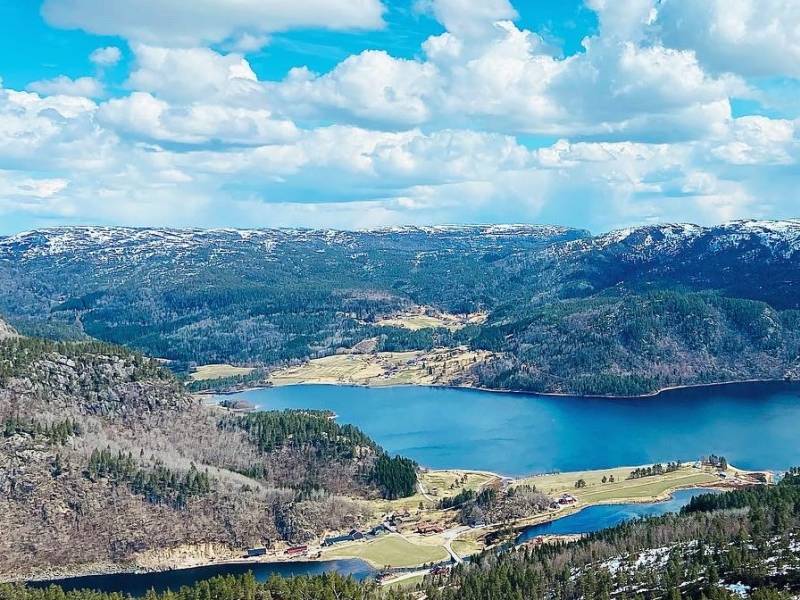
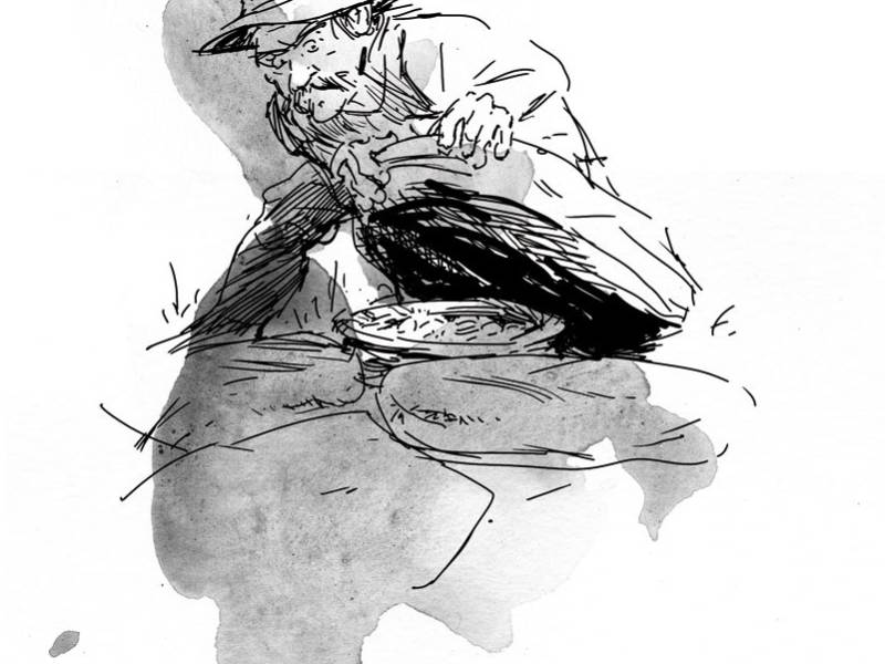
The hamlet in this story is called Lognavatn. The Tailor lived at Austegard, some kilometres further east. According to the tale, the Tailor had hidden a copper kettle full of money. Many people have been looking for it, but the treasure is yet to be found … Here is another extract from The Tale of the Tailor: As his last days approached, he wanted to reveal the kettle’s hiding place, and he sent for Gunnuv. But it was too late: When Gunnuv arrived, his father could no longer speak. The people on the farm carried Knut to the doorstep, and he pointed towards the place called Aasen, and they realised where he kept the money. They went looking for the money, but did not find anything. Sometime later, a man from the hamlet Espelidi walked through this area, cutting willow branches. He accidentally stepped on a stone that moved, and heard a noise from the scree below. Finding this peculiar, he took a closer look. Then he discovered a copper kettle in the scree. He got ready to fetch it, but suddenly he saw that his houses at Espelid were ablaze. He ran as fast as he could, but when he got home, there was no fire, and his houses were still standing. He turned and walked back to the scree to collect the kettle, but then the kettle was gone.


The gorge “Bjønnespranget” (“the Bear Leap”) and the waterfall Heddefossen are definitively worth stopping by and exploring. These are marvellous examples of how nature itself shapes the landscape. For your own safety, please note that the river is regulated. The name comes from an ancient myth about a man who was attacked by a bear. In this place, the river runs through a deep gorge, and the man managed to leap across it, thereby saving his life. The bear, however, did not dare to make the leap.


“Kjeddingsteinen” (“the old crone stone”), located next to the road, is a large boulder, which evidently has not tumbled down from the mountains, as it then would have ended up far into the bog. This gave rise to a myth about an old crone who carried the boulder and placed it there in the year 1000 AD, and was supposed to return in the year 2000 to collect it. At the time of the predicted return, local people talked about the ancient myth, but so far, the old crone has not arrived.


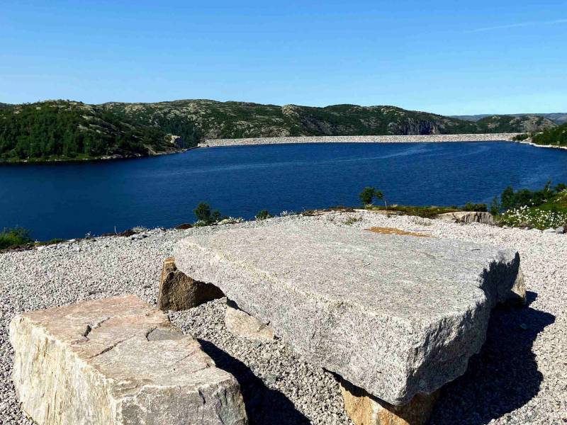
Somewhat further ahead there is a crossroads, with Eikerapen as an alternative. This is a small, idyllic hamlet overlooking the valley. If you are hungry, you may have a delicious meal in the restaurant at the hotel Eikerapen Gjestegard. Or if you want to get some fresh air, a walk around the lake Storevatn is recommended. On the way to Eikerapen you pass the Skjerka power station and may take a detour along the road Søteheivegen to the stone-filled dams that were completed in 2018. A great place to enjoy your packed lunch.

There are excellent swimming spots all around Åseral, but please note that most waterways are regulated. In Kyrkjebygda, not far from the town hall, there are two great alternatives – Lislehylen and Storehylen – with sandy beaches, benches and tables, a barbecue area, a sand volleyball court and public restrooms. In Lognavatn, close to the Åknes chapel, you will find one of Åseral’s finest swimming spots, with a sandy beach, benches and tables, a barbecue area, a sand volleyball court and public restrooms. Bortelid offers sandy beaches that are great for families with children, by the lakes Rundatjønn and Bortelidtjønna. Along the stream Murtebekken, running south from the centre of Bortelid, there are several natural deep pools. In Ljosland, there are nice natural deep pools along the river, by the mountain lodge Ljosland Fjellstove, when the water level is low. You may also take a dip in the lake Ljoslandsvatnet, by the cabin village in Kløystøl, or in the waterfall between Tjønna and Langevatn.


There are excellent swimming spots all around Åseral, but please note that most waterways are regulated. In Kyrkjebygda, not far from the town hall, there are two great alternatives – Lislehylen and Storehylen – with sandy beaches, benches and tables, a barbecue area, a sand volleyball court and public restrooms. In Lognavatn, close to the Åknes chapel, you will find one of Åseral’s finest swimming spots, with a sandy beach, benches and tables, a barbecue area, a sand volleyball court and public restrooms. Bortelid offers sandy beaches that are great for families with children, by the lakes Rundatjønn and Bortelidtjønna. Along the stream Murtebekken, running south from the centre of Bortelid, there are several natural deep pools. In Ljosland, there are nice natural deep pools along the river, by the mountain lodge Ljosland Fjellstove, when the water level is low. You may also take a dip in the lake Ljoslandsvatnet, by the cabin village in Kløystøl, or in the waterfall between Tjønna and Langevatn.
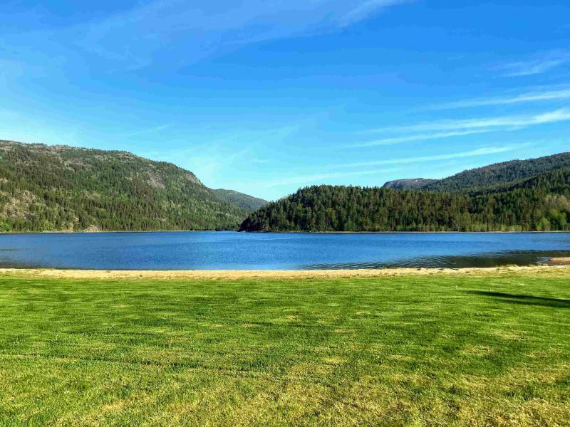


There are excellent swimming spots all around Åseral, but please note that most waterways are regulated. In Kyrkjebygda, not far from the town hall, there are two great alternatives – Lislehylen and Storehylen – with sandy beaches, benches and tables, a barbecue area, a sand volleyball court and public restrooms. In Lognavatn, close to the Åknes chapel, you will find one of Åseral’s finest swimming spots, with a sandy beach, benches and tables, a barbecue area, a sand volleyball court and public restrooms. Bortelid offers sandy beaches that are great for families with children, by the lakes Rundatjønn and Bortelidtjønna. Along the stream Murtebekken, running south from the centre of Bortelid, there are several natural deep pools. In Ljosland, there are nice natural deep pools along the river, by the mountain lodge Ljosland Fjellstove, when the water level is low. You may also take a dip in the lake Ljoslandsvatnet, by the cabin village in Kløystøl, or in the waterfall between Tjønna and Langevatn.

There are excellent swimming spots all around Åseral, but please note that most waterways are regulated. In Kyrkjebygda, not far from the town hall, there are two great alternatives – Lislehylen and Storehylen – with sandy beaches, benches and tables, a barbecue area, a sand volleyball court and public restrooms. In Lognavatn, close to the Åknes chapel, you will find one of Åseral’s finest swimming spots, with a sandy beach, benches and tables, a barbecue area, a sand volleyball court and public restrooms. Bortelid offers sandy beaches that are great for families with children, by the lakes Rundatjønn and Bortelidtjønna. Along the stream Murtebekken, running south from the centre of Bortelid, there are several natural deep pools. In Ljosland, there are nice natural deep pools along the river, by the mountain lodge Ljosland Fjellstove, when the water level is low. You may also take a dip in the lake Ljoslandsvatnet, by the cabin village in Kløystøl, or in the waterfall between Tjønna and Langevatn.

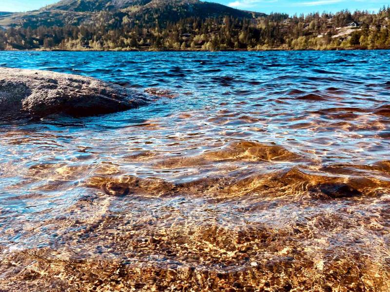
There are several opportunities for fishing in Åseral. In the southern end of the lake Ljoslandsvatnet in Ljosland and in Torsland, just south of Kyrkjebygda, you will find adapted fishing spots with parking space, tables and benches. In Bortelid, by the lake Rundatjønn, there are a number of nice fishing spots around the entire lake. For more information and an interactive map, see www.inatur.no. Select the freshwater fishing option and search for “Åseral fiskeadministrasjon”. Find your preferred type of fishing permit and pay with your bank card. The tourist information at the Minne Cultural Centre will also be able to assist you.
There are several opportunities for fishing in Åseral. In the southern end of the lake Ljoslandsvatnet in Ljosland and in Torsland, just south of Kyrkjebygda, you will find adapted fishing spots with parking space, tables and benches. In Bortelid, by the lake Rundatjønn, there are a number of nice fishing spots around the entire lake. For more information and an interactive map, see www.inatur.no. Select the freshwater fishing option and search for “Åseral fiskeadministrasjon”. Find your preferred type of fishing permit and pay with your bank card. The tourist information at the Minne Cultural Centre will also be able to assist you.

There are several opportunities for fishing in Åseral. In the southern end of the lake Ljoslandsvatnet in Ljosland and in Torsland, just south of Kyrkjebygda, you will find adapted fishing spots with parking space, tables and benches. In Bortelid, by the lake Rundatjønn, there are a number of nice fishing spots around the entire lake. For more information and an interactive map, see www.inatur.no. Select the freshwater fishing option and search for “Åseral fiskeadministrasjon”. Find your preferred type of fishing permit and pay with your bank card. The tourist information at the Minne Cultural Centre will also be able to assist you.

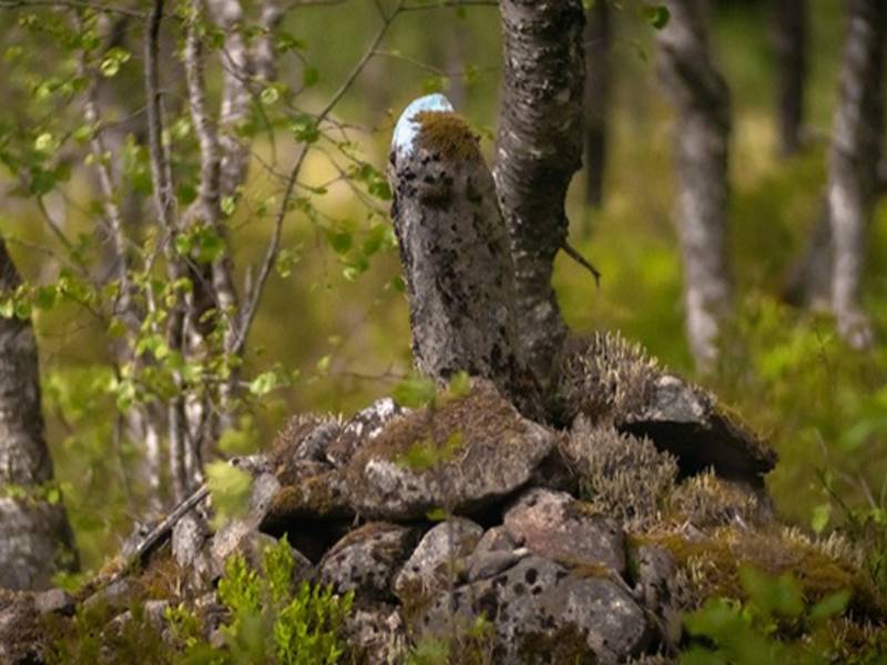
Not far from the local gas station in Kyrkjebygda, the old town road to Sveindal in the neighbouring municipality begins. A few kilometres to the south, along this road, is a well-preserved pile of rocks. In this region of Norway, most such structures are very old, but this one is considered the most recent one. People passing by threw stones onto the pile until the new road opened in the 1870s. Such piles could be made from rocks or branches that were thrown on top of each other to mark or commemorate a dramatic event. Walking past such a pile without throwing anything meant bad luck. In 1856, a man lost his life here. His name was Lars Knutsson Handeland, and he was on his way to church – in the company of two other men. A fourth man, who followed somewhat behind them, found Lars lying on the ground. He was brought on a sled down to the village, where he died. A doctor was summoned, and there was a police interrogation, but his companions claimed to know nothing about what had happened. He had fallen behind, they said, and they had not thought much about it. They concluded that he must have suffered the injuries from a fall. The pile of rocks is located on the place where he was found.
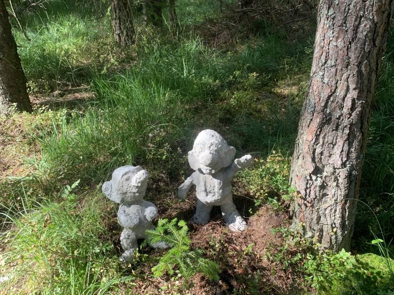
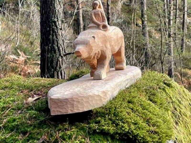
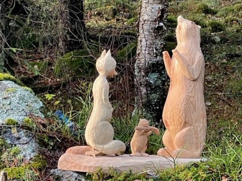
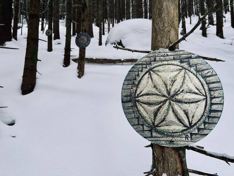
The fairytale bridge you are standing next to, is the beginning of the fairytale path which will take you further up the hill. There are many nice surprises along the path, if you try to observe the surroundings. The bridge crosses a small stream, and many people claim to have heard the border-stone ghost on this spot. In Norwegian, this character has many names, and in Åseral it is mainly called “bytegasten”. The border between properties were generally marked with border stones. They were flat stones placed edgewise between two smaller stones, thereby also indicating the direction of the borderline. Stealing land by moving border stones has always been considered a very serious crime. Whoever does such a thing becomes a border stone ghost, an afterlife punishment. You may hear the border stone ghost at night when he is trying to move the border stone back to its original and correct place.

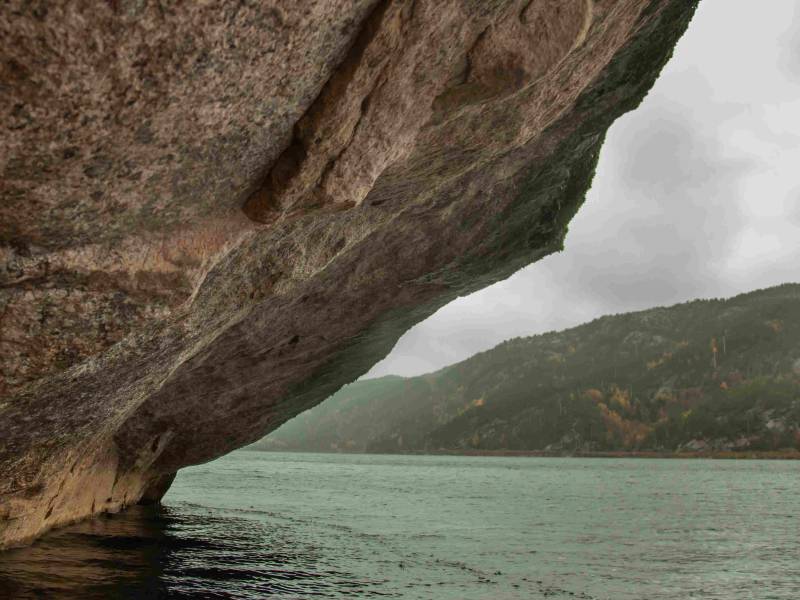


The beautiful lake next to the road, with the municipal centre Kyrkjebygda at its northern end, is called Øre. On the other side of the lake, there is a protruding ledge just above the surface of the water. This was called “Skiphedderen” (“the Ship’s ledge”). According to the legend, this is where St. Olav, who was to become Norway’s patron saint, sailed in with his ship – to finally appear again in the distant town of Nidaros. There is also a local version of this legend: “St. Olav and his men rowed beneath the ledge ‘Skiphedderen’ and disappeared. They turned up again in Kvinesdal.” Practically every village in Norway is connected to St. Olav through one or more legends. Also Åseral, although the legends are quite few and not especially dramatic. Still, they tell us a lot about the person Olav Haraldsson and his significant position in Norwegian religious history for more than 1000 years. If you want to see where you end up, you may explore the ledge close up. You may rent a canoe at the hotel Eikerapen Gjestegard or at the Minne Cultural Centre in Kyrkjebygda.
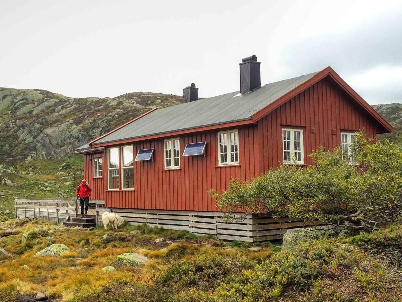

Lakkenstova is a self-service DNT cabin located north of the mountain Skoræ and the lake Lisla Øyvatn. The hike from Ljosland to Lakkenstova – with an overnight stay – is excellent for families with children. This cabin is situated well above the treeline, in a magnificent mountain terrain. Lakkenstova has a supply of staple food items and is unlocked. The main cabin has 26 beds, and the emergency cabin has 10. The emergency cabin has a dedicated room for those hiking with a dog. The hike to Lakkenstova and back is approximately 14 kilometres if you start from the Ljosland Ski Centre, where there is a large car park. During the summer season, parking is also possible by the Kvernevatn dam.

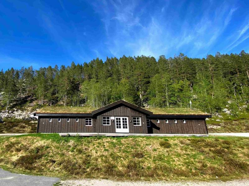


Bortelid Camping is a year-round, high-standard camping site in beautiful surroundings by the lake Murtetjønn. The Skardhei activity area with bike trails and climbing wall is located nearby, and there are several kilometres of hiking trails and walking paths in the area. The camping site is available for long- and short-term use by caravans and campervans, and stays open throughout the summer. It is also specially adapted for winter camping – with all required services.


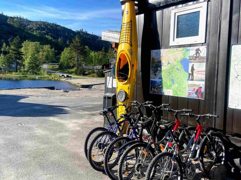
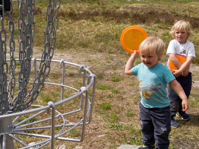
How about a swim? The lake Bortelidtjønna is centrally located in Bortelid, close to the grocery store. This is an attractive outdoor area with a popular sandy beach. You may also try your luck at fishing – or go kayaking, canoeing or testing an SUP board. If you have not brought own gear, you may rent all you need at Bortelid. If you are still restless, take a walk around the entire lake on a nice, adapted trail. There are also possibilities for longer expeditions in the area – on foot, on roller skis and on bicycle. How about mini golf and frisbee golf? Or maybe you just want to relax with a book while your family takes a round on the course?


Homvasshei, at 708 metres, is a nice hike in Eikerapen. Start from the ski centre, where there is a car park. Follow the marked trail up the hill, to the left of the ski lift and further along the river. At the small lake Kråkelitjønnæ the trail levels out. Walk along the lake and take left across the bridge at the southern end of the lake Storavatnet. Follow the trail along the western bank of the lake until the next trail crossing. Take to the left towards Storeslåtta, where there is a small, red cabin. Continue in the same direction and along the stream to the mountain ridge, which you follow to the highest point. This is an 8-kilometre return trip. If you prefer a hike around the lake Storavatn, just follow the trail, and you get a nice 10-kilometre round trip. Along the way, you may take a break at the barbecue hut or a dip in the lake. From this trail you can see the stone-filled dam at Heddersvika, which received an award for good building practice upon completion in 2018. A basic map of the area is available at Eikerapen Gjestegard. A more detailed hiking map of Åseral is for sale at the Minne Cultural Centre.


From the car park at the Bortelid Ski Centre, several summits are within reach for avid hikers, for example the 985-metre Skrivarknuten, with the actual summit within the SVR protected area. The purpose of the protection is to preserve a continuous mountain area with its fauna and flora, summer mountain farms and other cultural treasures. The most important aspect, however, it to preserve important sections of the wild reindeer habitat. Starting from the Bortelid Ski Centre, follow the DNT trail towards Gaukhei. Stay on this trail until you see the signpost to Skrivarknuten by the lake Vetreskardtjønna. Continue west to Skrivarknuten, 2.5 kilometres from the Gaukhei trail. Total length of the hike is 10 kilometres (including the return). If you want a somewhat shorter hike, you may walk around the lake instead of going all the way to Skrivarknuten. This is a 6-kilometre round trip from the ski centre; a perfect family hike. Map for sale at the grocery store Bortelid mat. Bortelid is an excellent starting for a point number of the red-marked DNT hikes in the Setesdal mountains, for example Lakkenstova, Josephsbu, Kvinen and Gaukhei.


Skoræ is one of the finest hikes in Åseral. At 1,041 metres above sea level, this is the southernmost Norwegian summit exceeding 1,000 metres and the tallest one in Åseral. The summit itself lies within the protected area called SVR (Setesdal Vesthei Ryfylkeheiane). The purpose of the protection is to preserve a continuous mountain area with its fauna and flora, summer mountain farms and other cultural treasures. The most important aspect, however, it to preserve important sections of the wild reindeer habitat. Follow the signposted trail from the lake Farevatn and up through the valley Farstøldalen until you reach the crossing at Skorstean. From here, there is a 2-kilometre hike to the summit of Skoræ. Total length of the hike is 10 kilometres (including the return). The trail is partially marked and cairned from Skorstean in the direction of the summit, and finding your way is easy. At the lake Farevatn there is a nice day-trip cabin with a large outdoor barbecue pan. The hike to this cabin is a great activity in itself for families with small children. Parking available at the Ljosland Ski Centre. Map for sale at Ljosland Fjellstove. Ljosland is an excellent starting point for a number of the red-marked DNT hikes in the Setesdal mountains, for example Lakkenstova, Josephsbu, Kvinen and Gaukhei.
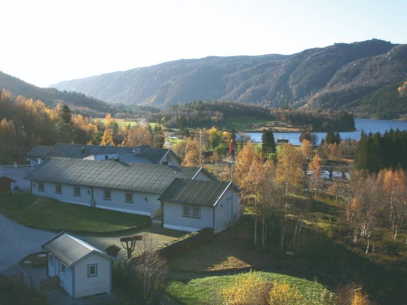

If “slow living” is one of your dreams, the mountain lodge Ljosland Fjellstove is just perfect. Take a pause from your busy daily life, and enjoy peace and quiet, tasty food and magnificent surroundings. Go hiking, biking or canoeing, or just relax and read a book. Bike and canoe rental is available. The rooms are newly refurbished, and the restaurant has an à la carte menu with homemade food. On Sundays, wild game is served. Another item on the menu is the self-composed pizza – also for takeaway. Ljosland Fjellstove was built in 1937 by the regional branch of the Norwegian Trekking Association (DNT), which ran it for 52 years under the name of “Ljoslandshytta”. In 1989, Asle Ljosland took over, and he modernised and rebuilt the tourist cabin. It was reopened in 1990, under the name “Ljosland Fjellstove”. In 2002 there was a change of owners, with Mikael F. Schlezinger and his family taking over. They are still in charge – and are pleased to welcome you to Ljosland!
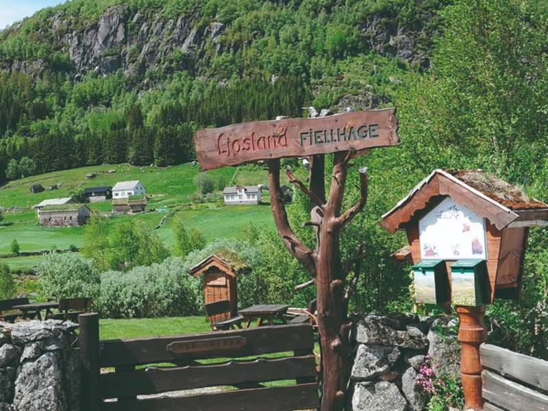
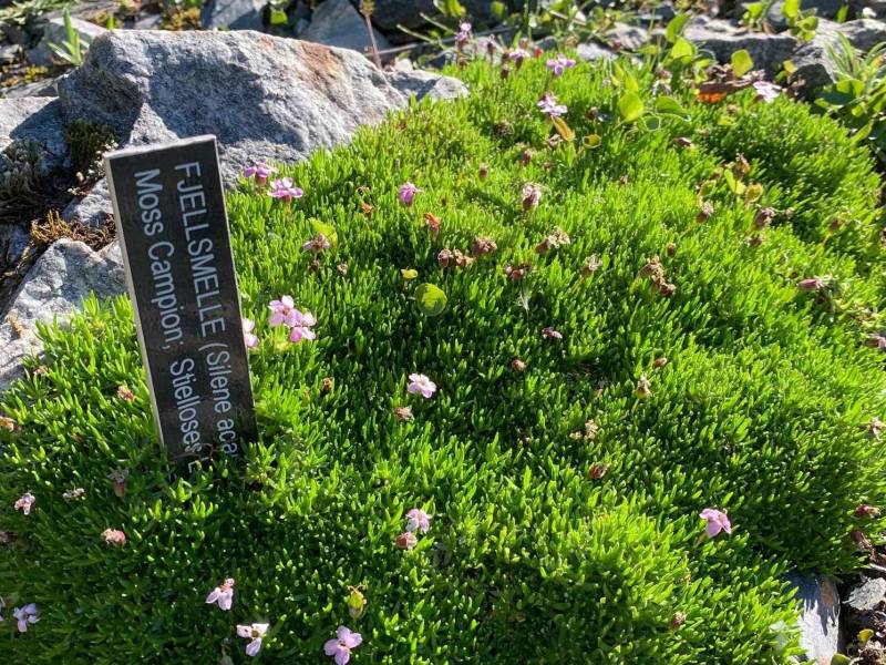
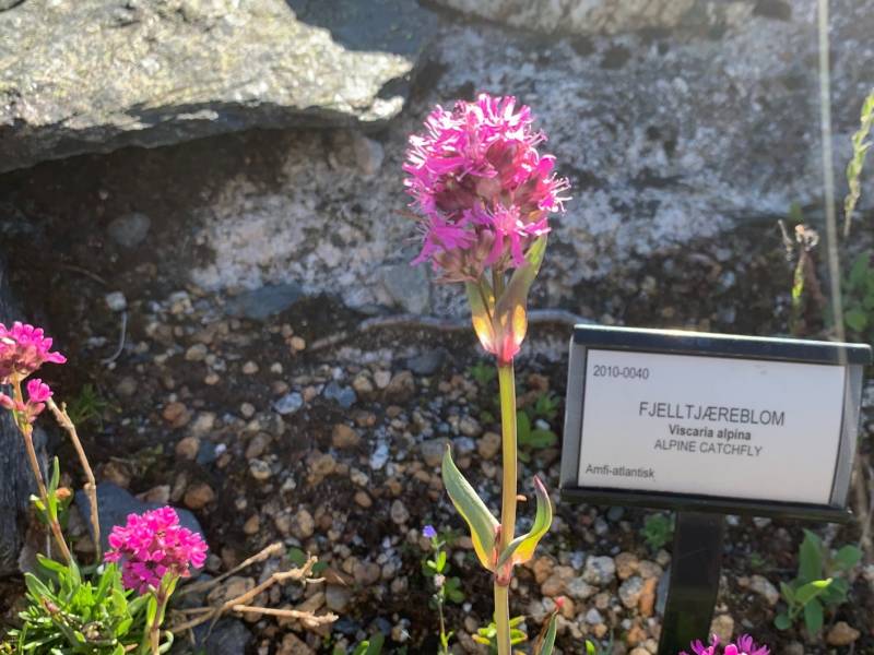

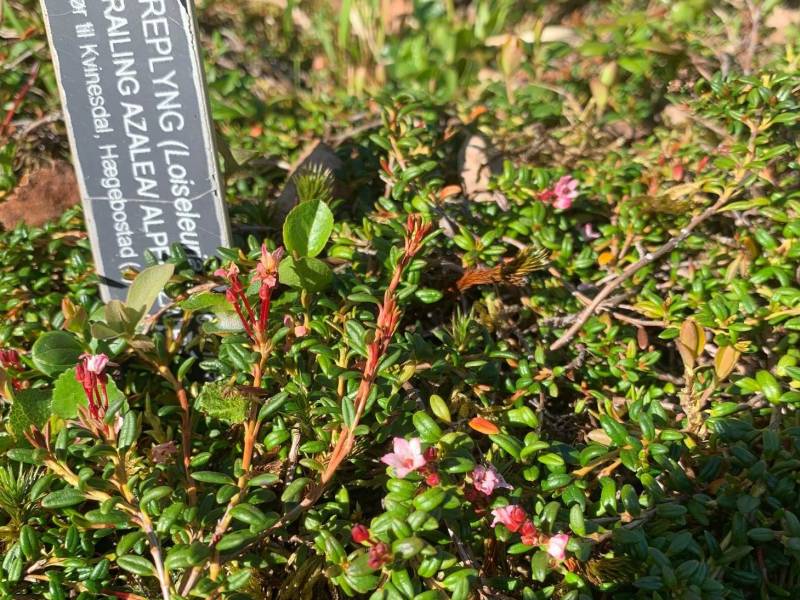

Time for a picnic break? The mountain garden is always open to the public, and the entrance is free. It is nicely situated in a semi-circle between Ljosland Fjellstove and the river, with a path accessible for wheelchair users. Tables and benches make it convenient for a picnic break while you enjoy the view of the river and the valley. The plants in the garden are mainly from the mountain areas above the treeline in Agder County, but there are also non-local plants – including some from the Arctic island of Svalbard. They are divided into various categories, according to their natural habitat, and even some red-listed plants are included.


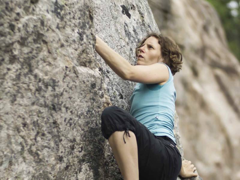
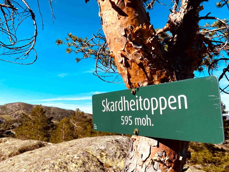


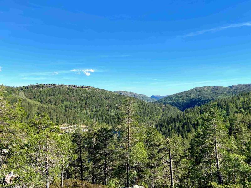
Skardhei is an activity area in Bortelid, with great tracks suitable for mountain biking. The tracks include the hill Skardheitoppen, at about 600 meters above sea level, with a view of the Bortelid cabin village. Only one kilometre to the south, you find the start of the single-track. Bicycle rental is available in Bortelid. If you like climbing, you have several options. The newest climbing wall is close to the Skardhei bike trail. Bring your own gear or go bouldering. If you feel like cooling down after these activities, there are some excellent swimming spots in this area.
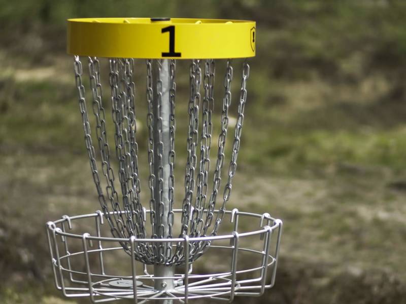
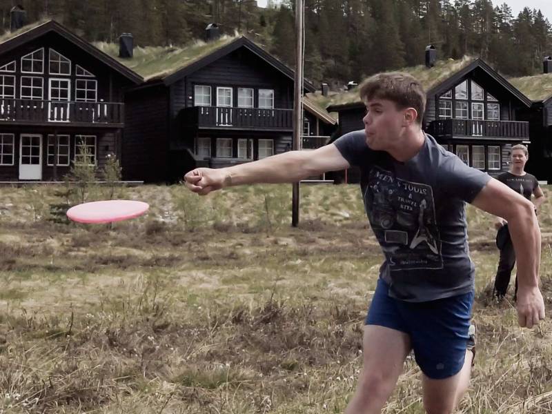
In Bortelid, you may try frisbee golf. In the area east of the ski centre there is a large course with 18 baskets. Frisbee golf is an activity that suits everyone and requires only a minimum of equipment. All you need is a frisbee! If you don’t have your own, you may buy one at the store in Bortelid. If you use all the 18 baskets, you will have a great walk of about 3.5 kilometres. The first nine baskets are located in slightly hilly terrain east of the ski centre and is a great round for beginners. If you continue with baskets 9 through 18, the terrain gets even hillier and makes for a more challenging game. Visit the service office in Bortelid for further information.

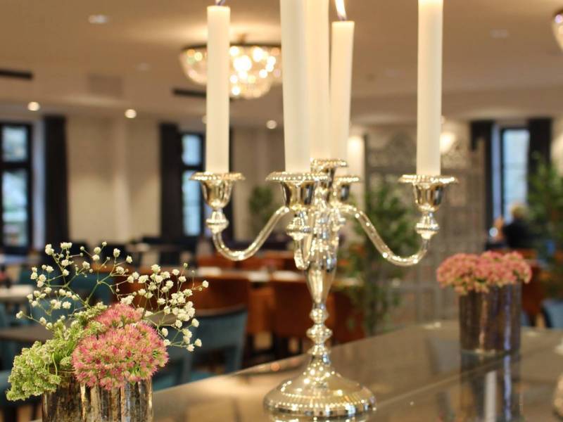
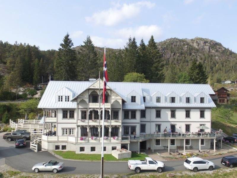
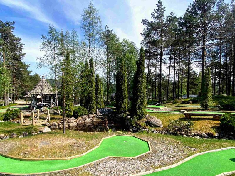
Welcome to the farm! The charming and beautifully situated hotel Eikerapen Gjestegard offers splendid views of the lake Øre as well as a delicious cuisine in the Thora Amalie Restaurant. Local food traditions mean a lot to the chef, as you can see from the menu. Ask for some of our favourites. The scenic surroundings invite to walks and hikes, and if you want to go fishing or canoeing, the hotel has canoes available. Or if you would like to test your mini golf skills, there is a course next to the hotel. This is a farming museum mainly focusing on horses and equestrian activities, but also on local cultural heritage through the use of old tools, food traditions and the local dialect. You may take part in horse-related activities, or take a guided tour through the premises, stopping by the blacksmith, the bakehouse and the storehouse. Horseback riding is available daily in the period April–October, by appointment. Early in July you may take part in the annual “scything days”, with an introduction to this and other ancient farming and housekeeping skills – as well as competitions and other activities.

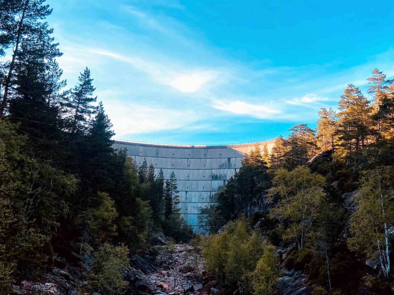
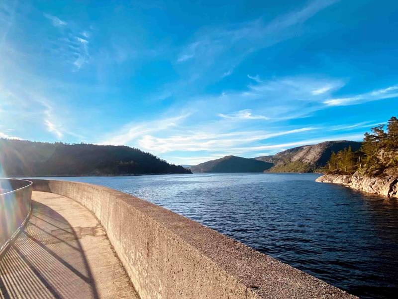

The Dam Juvass was completed in 1958 and is 46 metres high. At that time, it was considered the highest dam of its kind (combination bow and plate) in Northern Europe. The reservoir has a capacity of 142 million cubic metres of water. If you cross the dam on foot, taking in the magnificent views, it is a nice walk to the mountain farm Juvasstøl on the eastern side of the lake Juvatn. The path, which follows the shoreline, is not marked, but is easy to find.
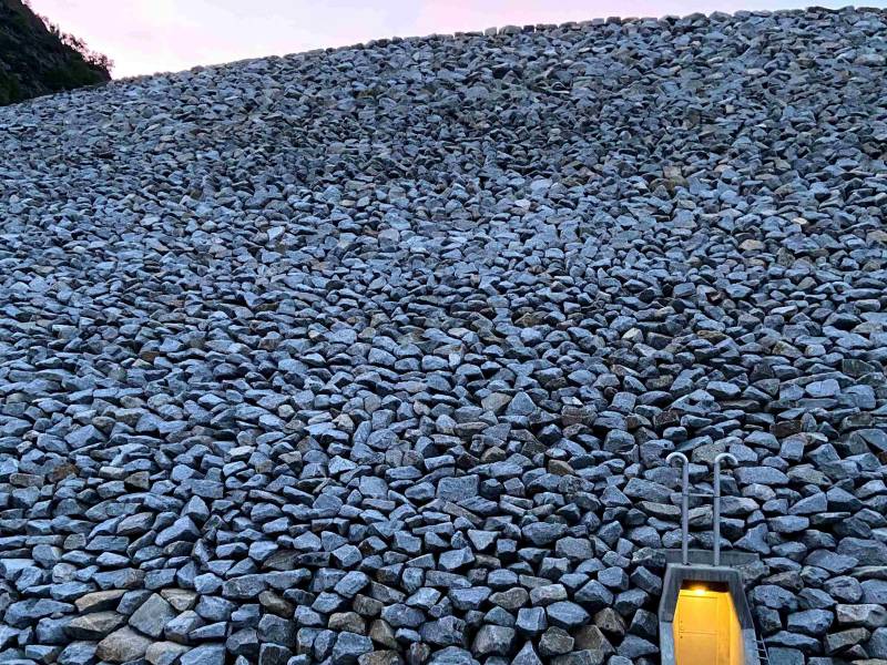

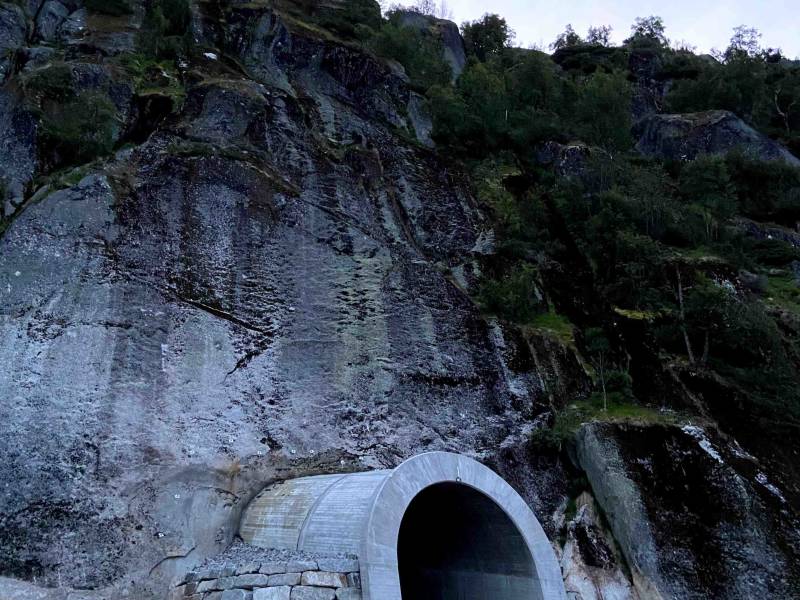
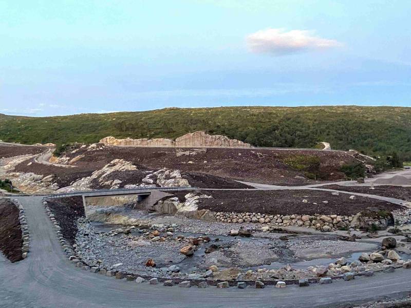
Here, in the southern part of the lake Langevatn, you see the large, stone-filled dam that was completed in 2020. The water level has been raised by 10 metres, and the variation in water level is currently 26 metres. Langevatn in Ljosland is the gateway to the western mountains of Setesdal and starting point for several of the red-marked trails of The Norwegian Trekking Association (DNT). The parking area for the dam in Gloppedalen is a nice starting point for bicycle trips, canoeing, kayaking and mountain hikes. The old cattle road extends for 8 kilometres along the lake. From the end of the road there are 3 kilometres to the mountain farm Pytten. Bicycle, canoe and kayak rental available at the mountain lodge Ljoslandshytta.


You are now heading towards the Skjerkevatn dams, located somewhat further into the mountains. The drive itself is an adventure – on a winding scenic road with hairpin turns. Enjoy the view! The hydropower projects were typical for the development of Åseral in the 20th century, and the extensive work at Skjerka had vast and permanent consequences for the local community. Already in 1914, two small power stations were set up, supplying electricity to various consumers. In 2018, two new stone-filled dams were completed at Skjerkevatn – Dam Heddersvika and Dam Skjerkevatn – replacing five old concrete dams. The new dams raised the water level to 23 metres. Now, the original Skjerkevatn and the former Nåvatn look like one reservoir. The stone-filled dams are an impressive sight, and in 2018, the energy supplier Agder Energi received a prestigious award for excellent design. From the Heddersvika dam you see the hiking area Storavatn in Eikerapen, not far from the local hotel. If you want to explore this part of Åseral further, you may book accommodation – either at the hotel or in one of the cabins.
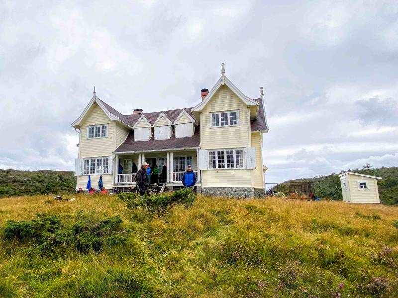

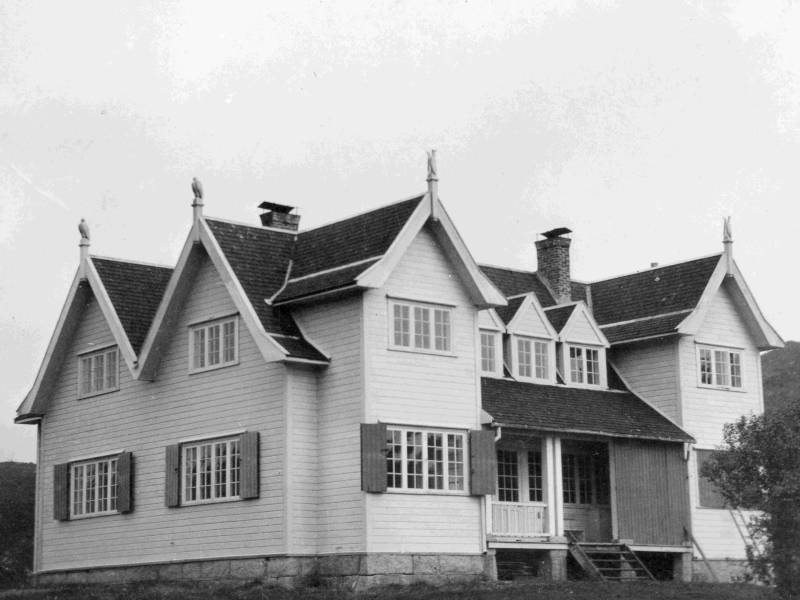
Far into the mountains you find the hunting lodge “Lordehytta”, built by Lord Salvesen from Edinburgh at the beginning of the 1900s. It towers magnificently and almost magically on the vast moor, with elaborately carved animal figures on the nine roof ridges. The architect was Robert Wyld. The 300-square metre lodge was originally set up in Mandal – before it was dismantled and relocated to the mountains in Åseral, where it was rebuilt. An exhausting task for those involved, and no small investment for Lord Salvesen. Being very fond of this place, Lord Salvesen and his family used it until World War 2. After a while, “Lordehytta” changed owners. Guided day hikes are organised in the period May–September. Please contact the hotel Eikerapen Gjestegard for information and price. If you want to know more about Lord Salvesen, there is an exhibition and a documentary film about him at the Minne Cultural Centre.


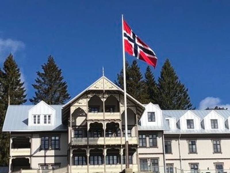
Time for a break? We recommend stopping at Lognavatn, by the small church made by the artist Håkon Torsland. This is approximately where the Åseral Tourist Hotel was located. If you need more information about this grand building, please look at the signpost here. This area was especially popular among British tourists, who were interested in leisure fishing and hunting. The hotel, which was completed in 1891, kept open during the summer season, until mid-September. It had 45 rooms and modern amenities like hot and cold running water. “Like a centre for health and sports (i.e. fishing), this hotel is practically unmatched in Norway”, according to an article in The Fishing Gazette from 1898. The hotel had fishing huts and boats for rent in several local lakes. One of those huts is still standing by the lake Stasvatn. Unfortunately, the hotel was destroyed in a fire in 1931, and was never rebuilt.
You are now passing through the Logndalen valley. According to the tale, the Tailor is buried in the area called «Urehajen», just north of the hamlet Rosseland. Would you like to know the exact place? Here is a small extract from the tale: In the morning, Knut made his way to Austegard, by the lake Lognevatnet. There were seven farmers in Austegard. He went to see one of them, entered his hall with his walking staff in hand, saying: «Here I place my staff. Here I shall live through many a good day». Entering the living quarters, he placed his hat on the table, saying: «Here I place my hat. Here I shall rest through many a good night.» He purchased three farms at the same time. After the death of Knut, when he was to set out on his final journey, the horses refused to drag him to his burial place. They stood like they were frozen. Then the farm people put a black mare in front. She kicked the coffin three times and whinnied three times, before she started moving. But she would not go any further than Rosseland, to the place known as Urdehagen. There, Knut was laid to rest, in a green field with a patch of sand the size of a grave. That became the Tailor’s grave.

This old storehouse, which is located at Austegard, belonged to the legendary tailor called Knut. Today, it is on private hands, but you are welcome to drop by and have a look. The storehouse was one of the most important buildings on a farm, designed for the storage of food provisions and clothes. According to an old legal act, Gulatingslova, you had the right to kill a man who was caught stealing from the storehouse. “Skraddarburet” at Austegard is the oldest non-religious building in this region of Norway. The ground floor is dendrochronologically dated to the 1520s, while the upper floor was added some time during the 1600s. The storehouse was named after Knut Nilssøn Mørk – or Knut Skraddar (tailor). According to local history books, Knut was sent from Denmark at a young age to his uncle in Bergen, to learn the tailor’s trade. He was supposed to have chased some thieves all the way to Vardø, in the extreme north of Norway, and for the reward he received from the king, he purchased Austegard and many other farms in Åseral.
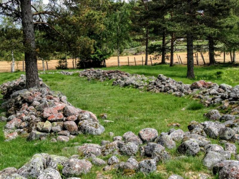

Welcome to Sosteli! This is one of the best preserved Iron Age farms in Europe. Sosteli was settled almost continuously from about the birth of Christ to 1000 AD. There are still traces of ancient house foundations, grave mounds, coal pits, fields and stone fences. Archaeological finds show that the farmers produced iron and hunted – in addition to ordinary farming. Some of these, and other artefacts that confirm contact with the outside world, are on exhibition at the Minne Cultural Centre. Pollination tests have shown that there was a forest in the area at the time before Christ. Through the Roman Period and the Migration Period this changed, however. There are traces of pollen from grass and other grazing plants, but it seems that grain farming gradually gained more ground. Another change takes place in the years 550–600 AD, with the forest returning. Although the ordinary farming continues, livestock keeping takes over as the main activity. The pollination tests also show that hemp was grown – for the production of ropes. This took place until around 1000 AD.
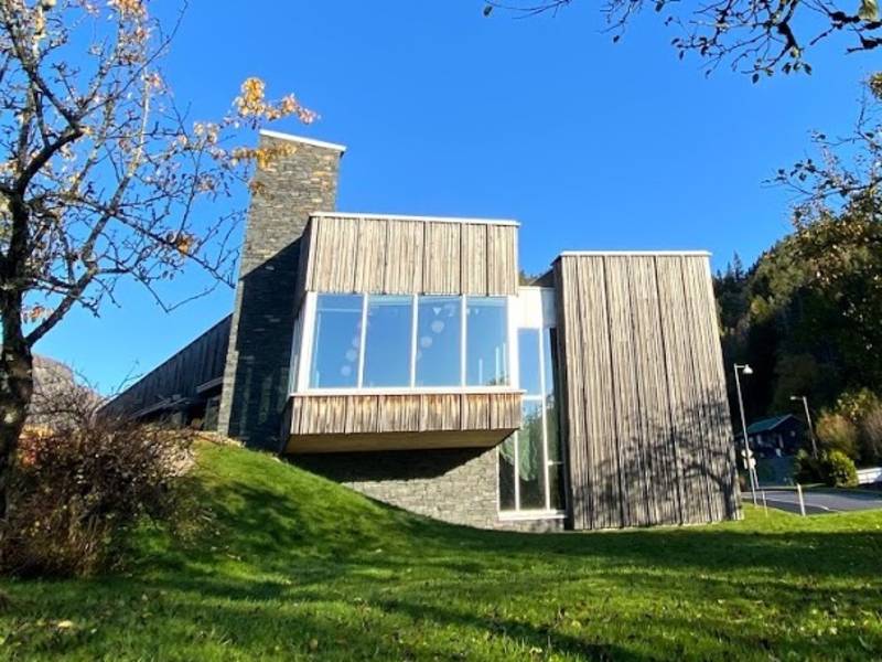
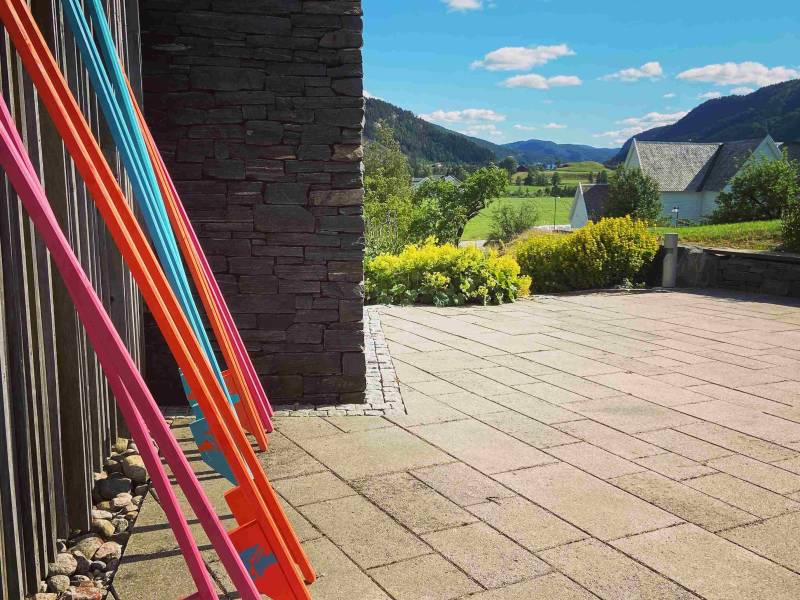

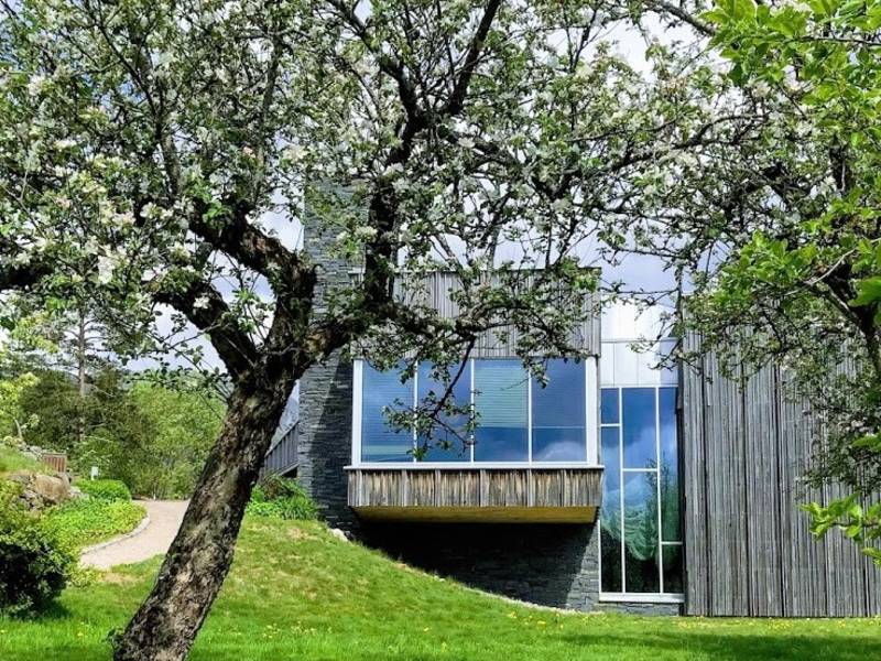
How about some ice cream and coffee? Drop by at the Minne Cultural Centre, a popular local meeting place. It is located in the heart of Åseral, next to the church, with magnificent views of the village and the lake Øre. Take a relaxing stroll through the unique Apple Garden or negotiate the climbing tower. At Minne, you also find the tourist information, exhibitions and documentary films covering local history, a library and a small café. In the month of July, various events take place. Check the website of Åseral municipality if you need more information. The farm which originally stood on these premises, was built sometime between 1880 and 1890, probably by Jacob Nilsson Berg, local sheriff in the years 1887–1892. The name is derived from "Mynne", interpreted as estuary, perhaps on the spot where the rivers Monn and Logna run into the lake Øre. In addition to being used by the police, with a house for the sheriff and a small detention house, the farm also served as a meteorological station. The farmyard at Minne was in several ways an important part of the village.